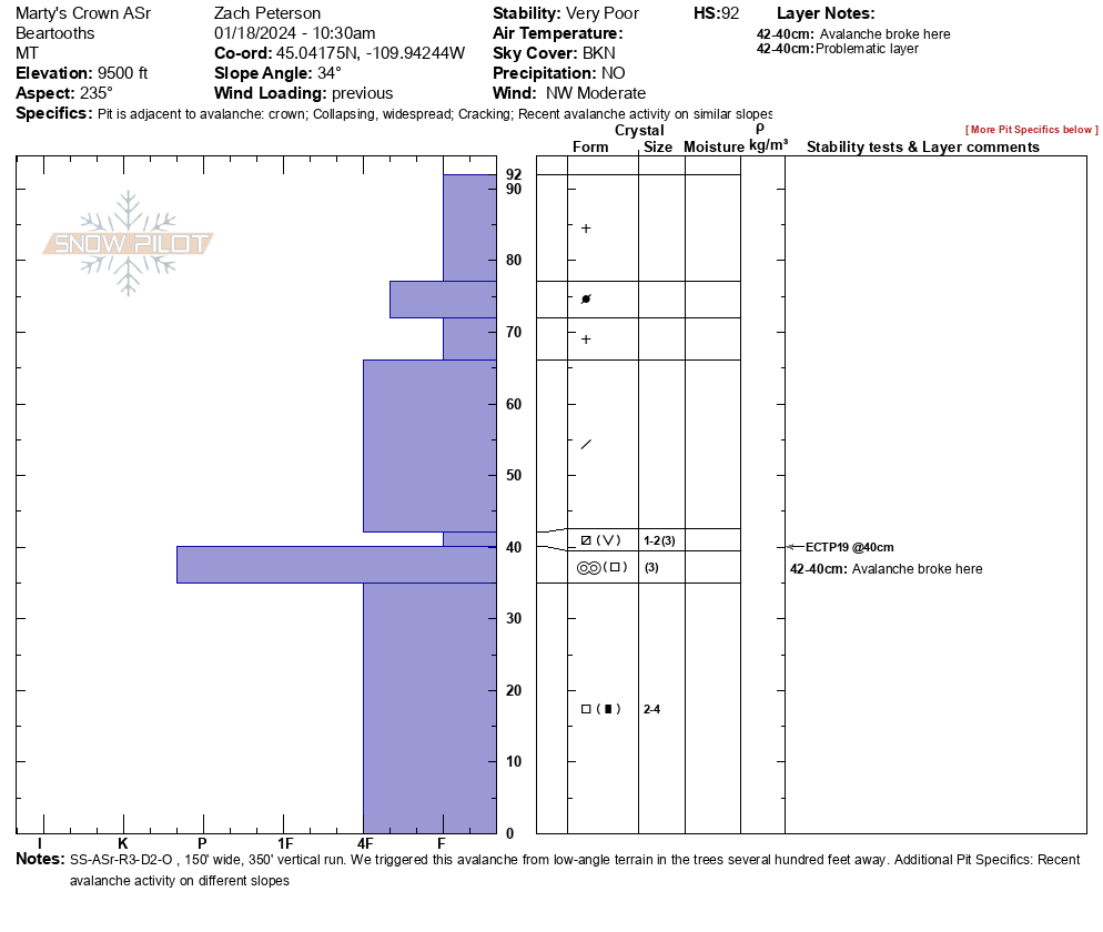
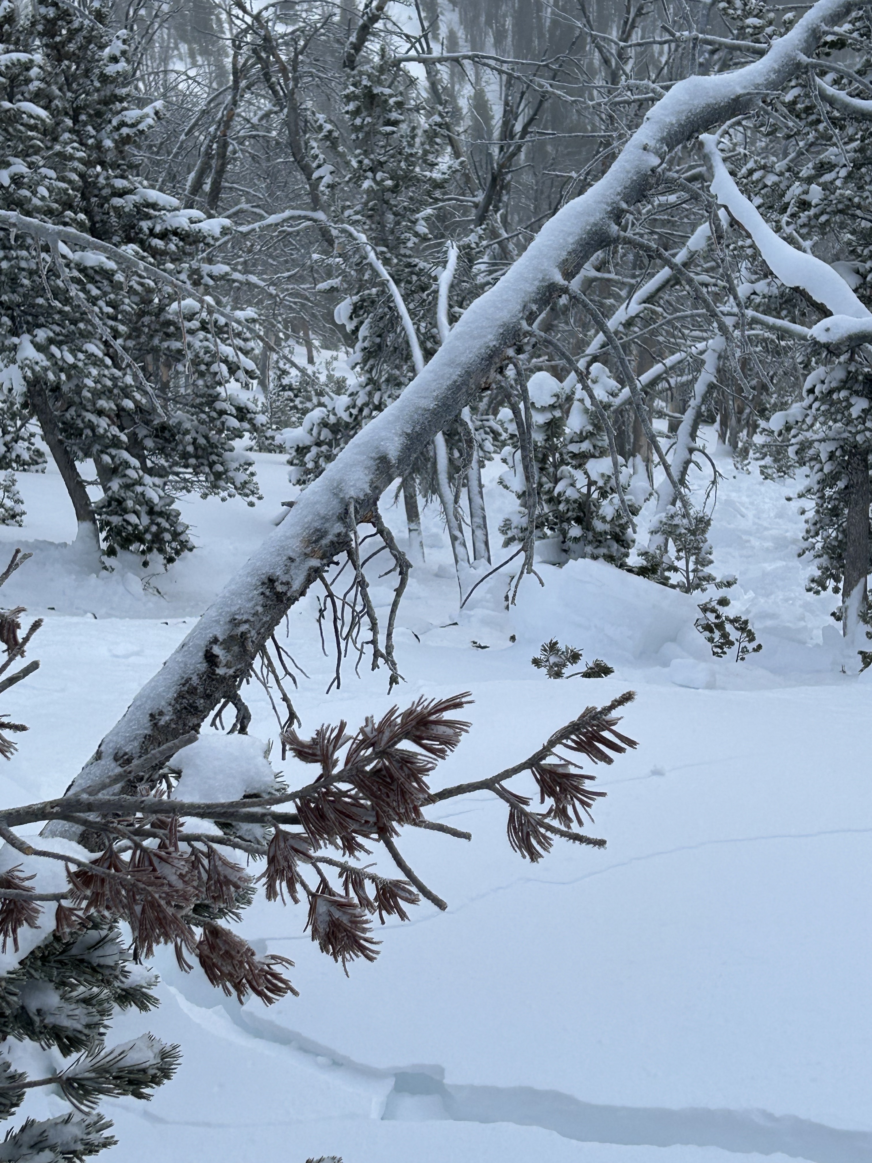
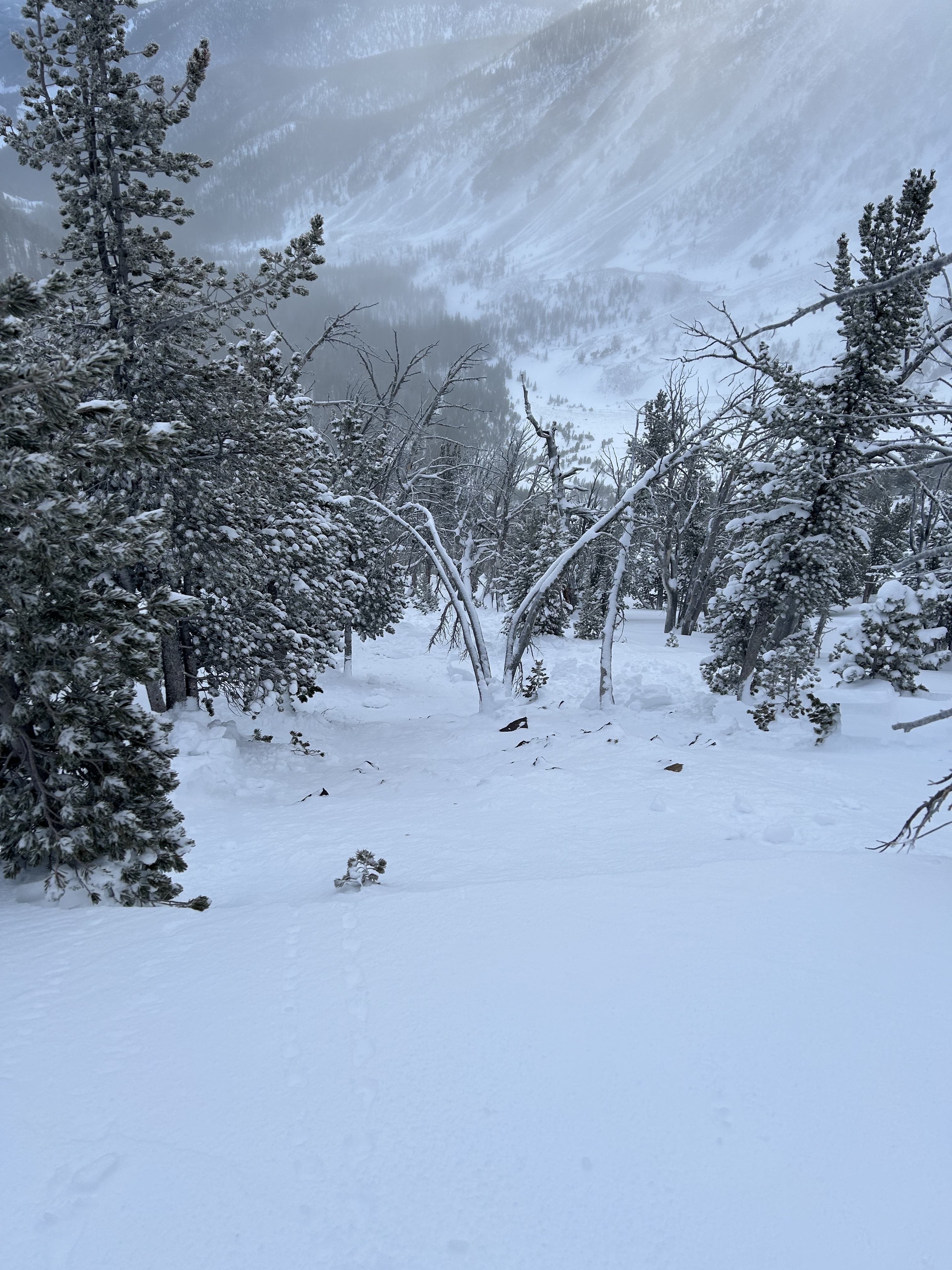
Snow Observations List
From interaction at the gas station:
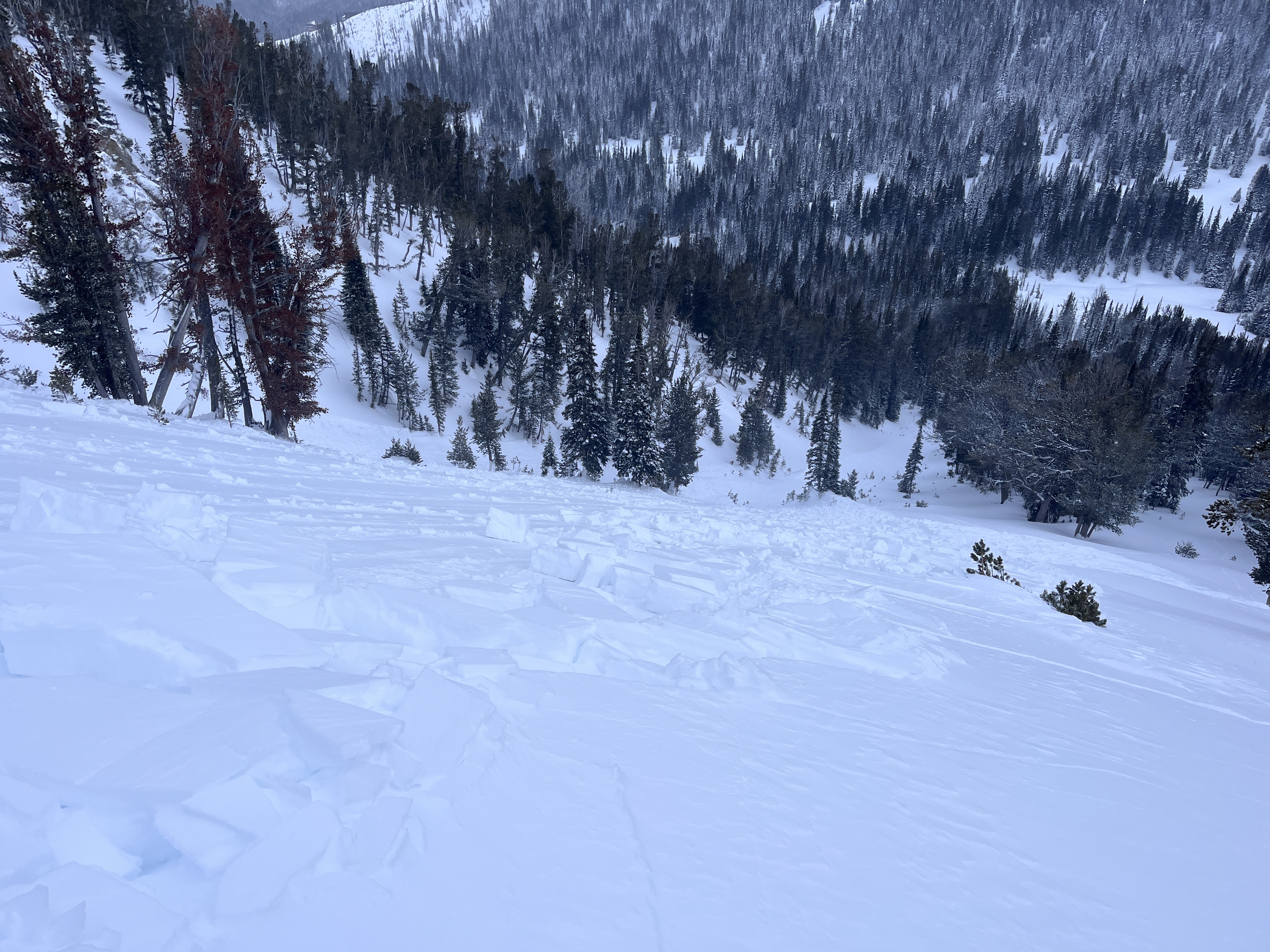
“We were riding out from Island Park. We saw dramatic, collapses, and shooting cracks. I side-hilled a small slope and triggered it 1.5 to 2 feet deep. I have never seen such unstable snow.”
Full Snow Observation Report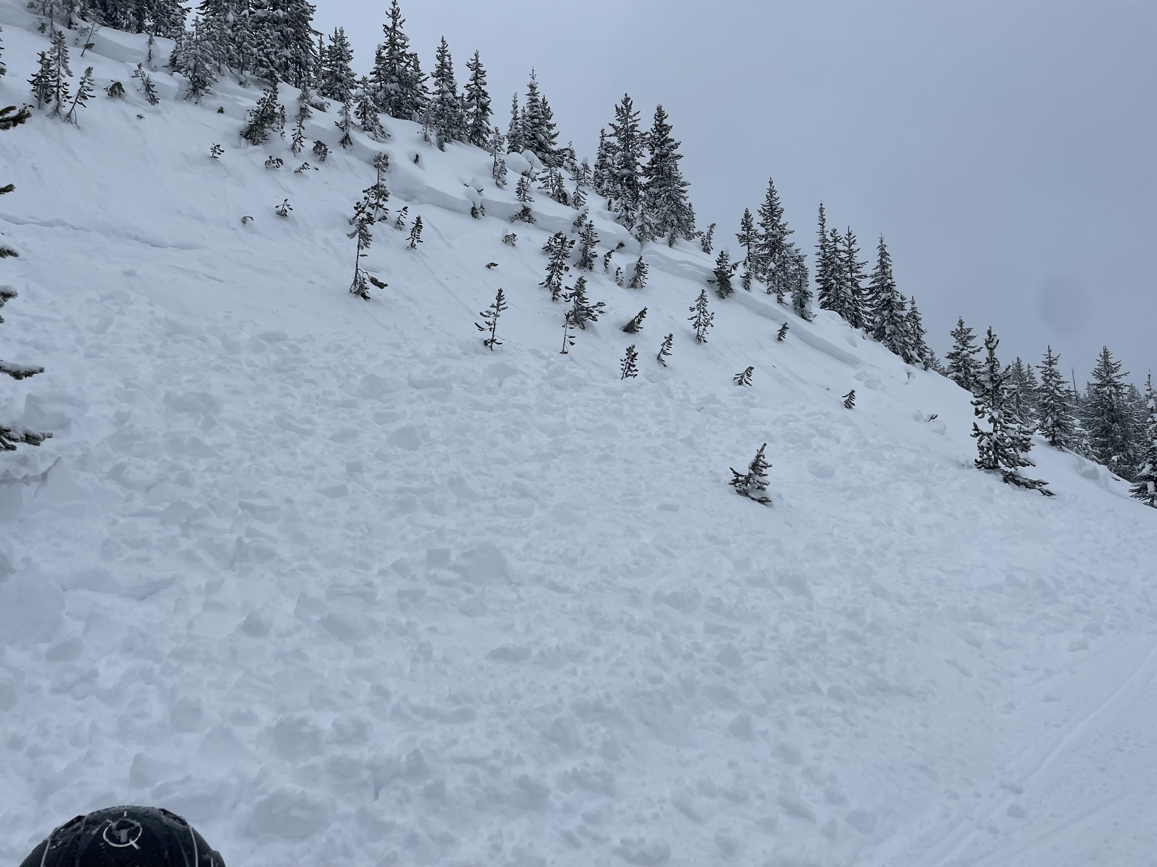
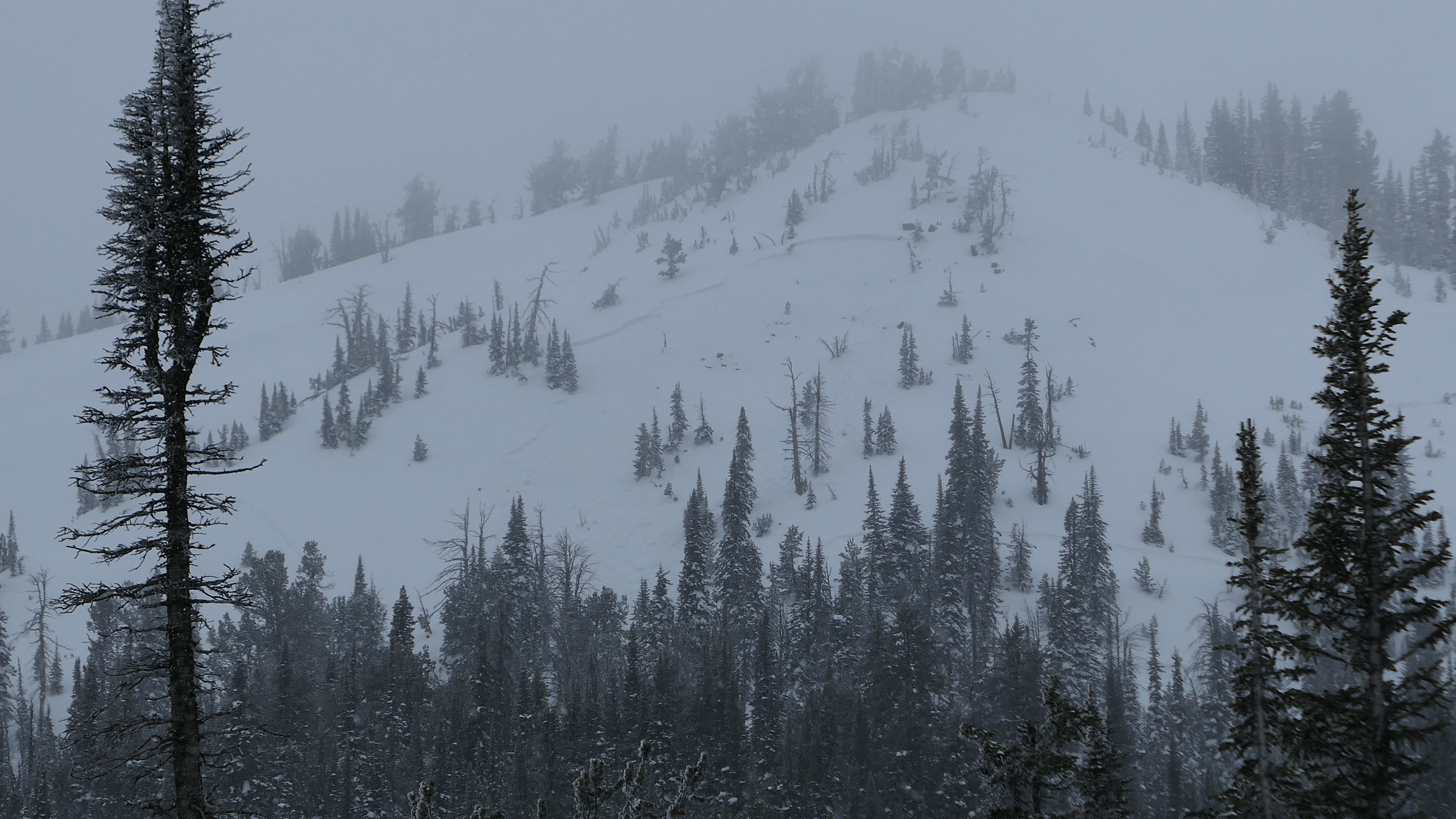
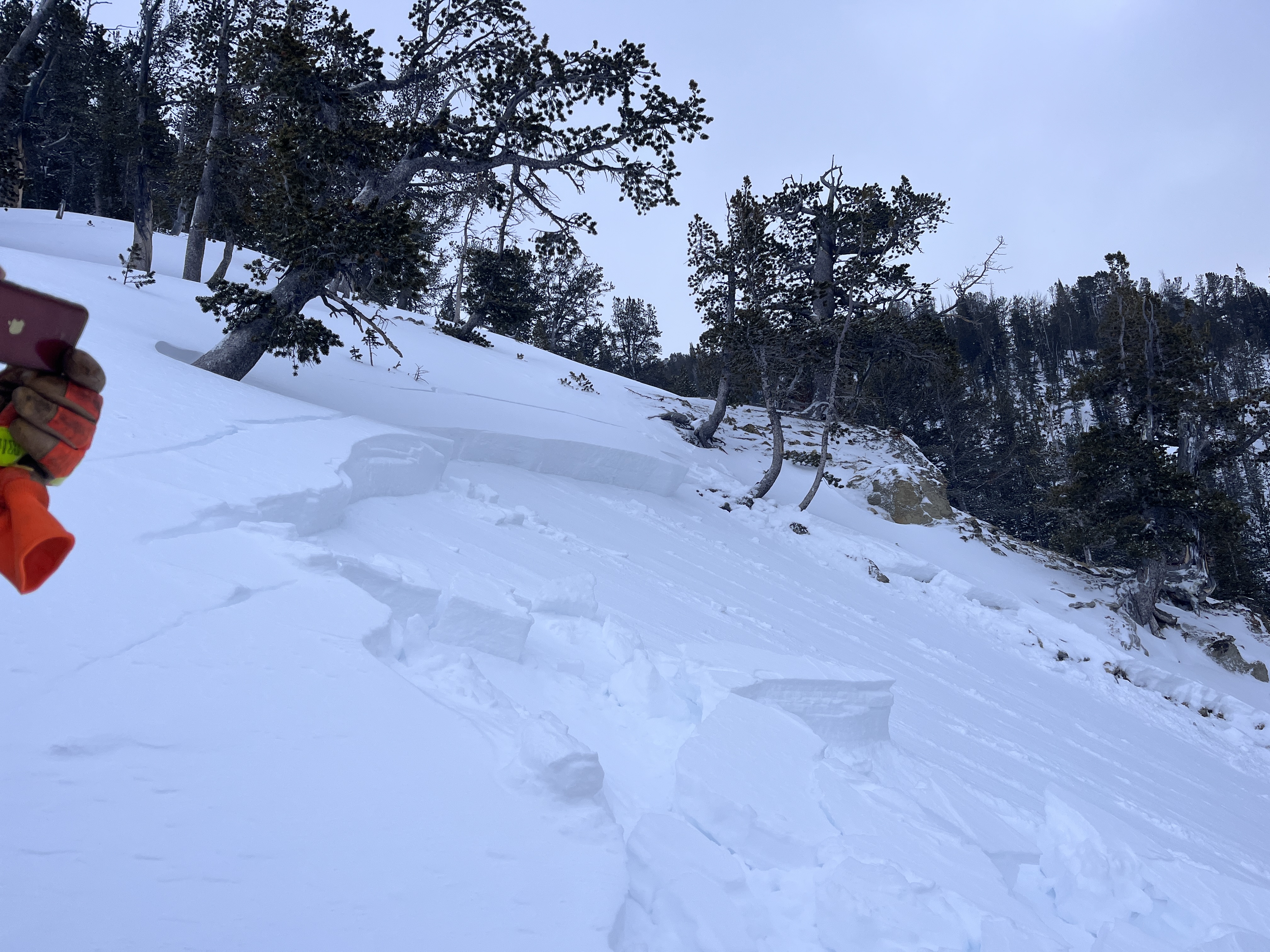
We dug pits and rode on Sawtelle Peak. At 9,100 feet we had unstable test results (ECTP13 x 5; ECTP10 x2; CT4, Q1). When the clouds lifted we could see a crown of a snowmobiler triggered slide that occured yesterday. It broke on the buried surface hoar and facets about 1.5 feet under the surface. Recent snow and wind-loading has created dangerous avalanche conditions.
The avalanche:

Dug pits both above and below Bradley Meadows with a Fundamentals Course. We got ECTNx5 down 30cm on the facets which were first buried Jan 5th. The snow overlying the facets was soft (fist to four finger).
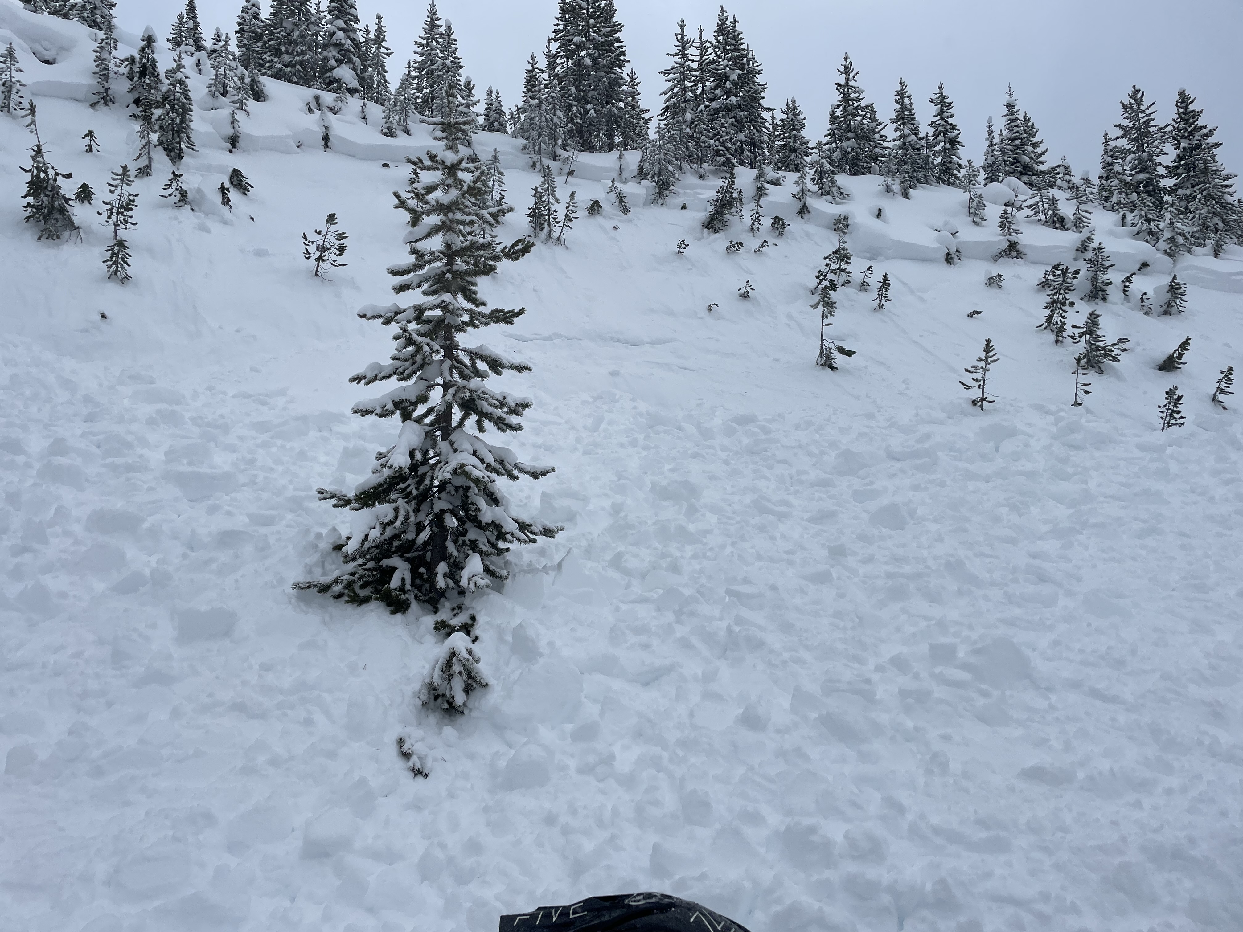
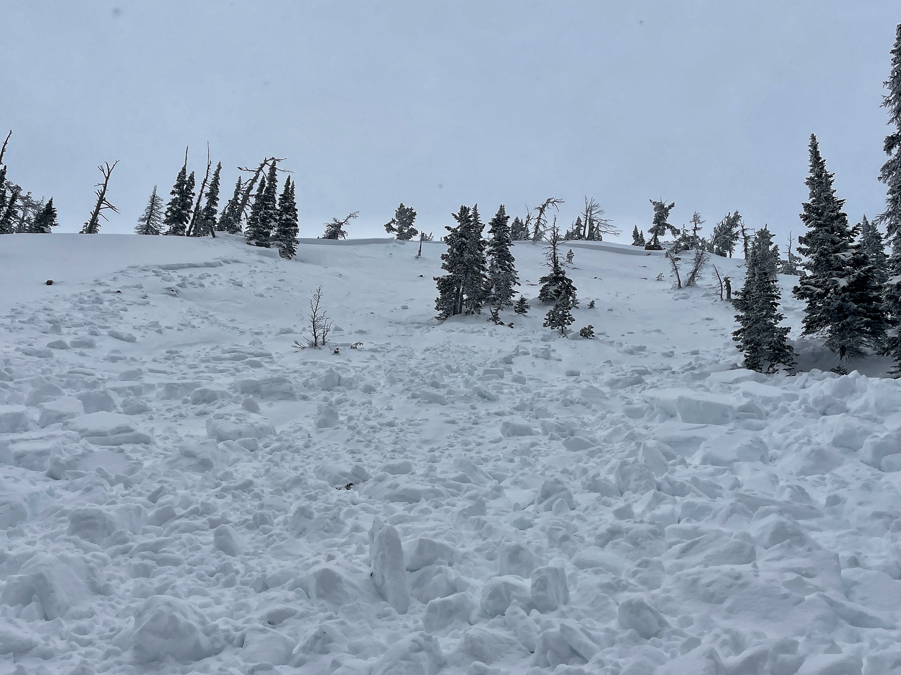
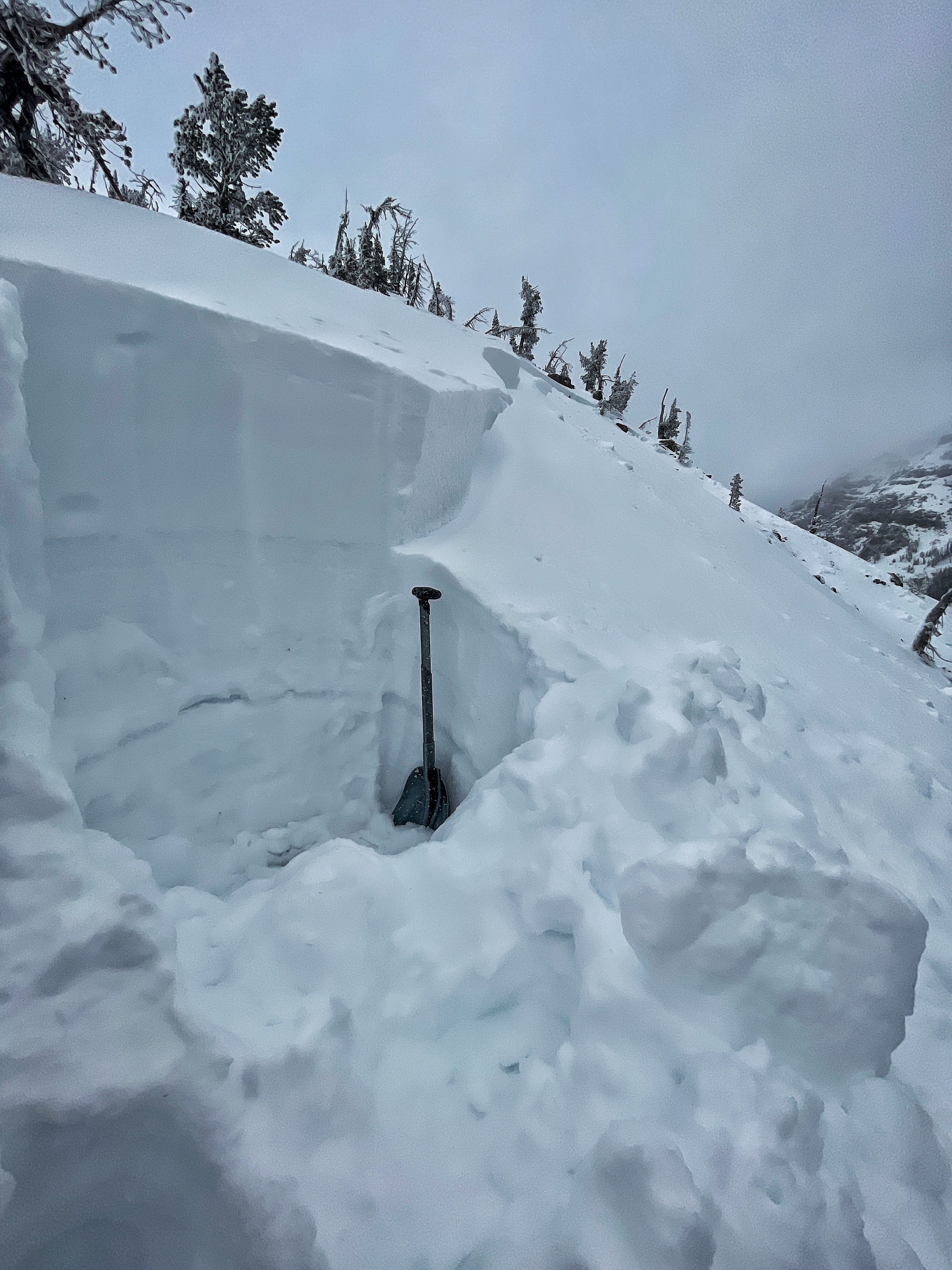
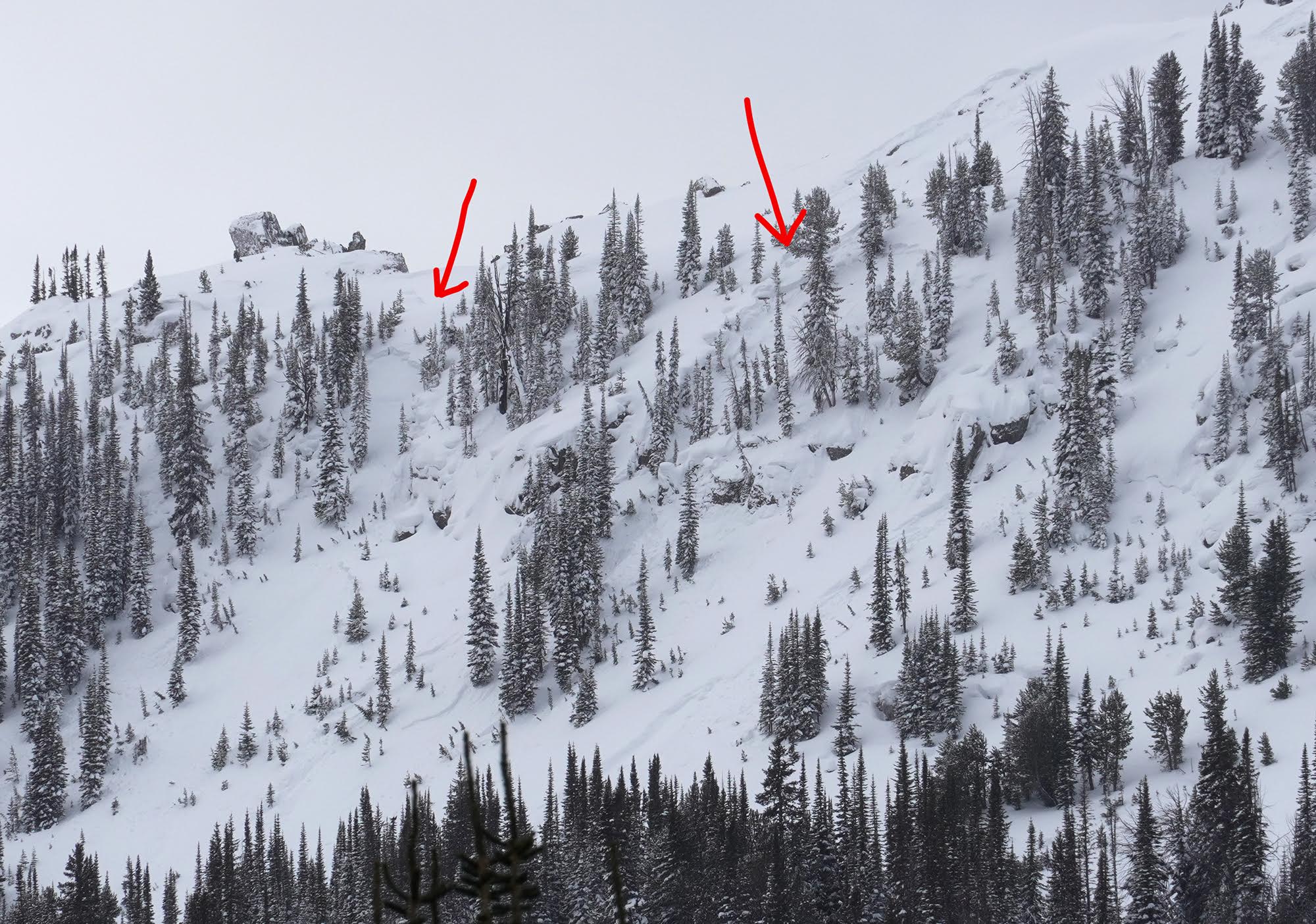
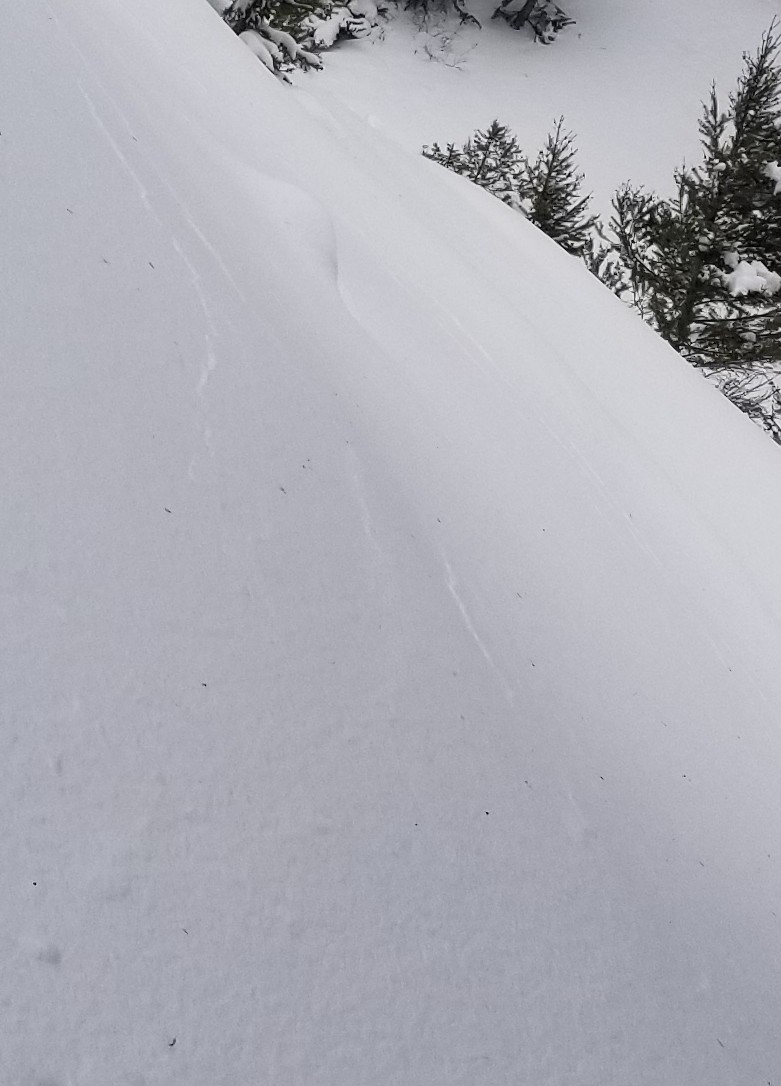
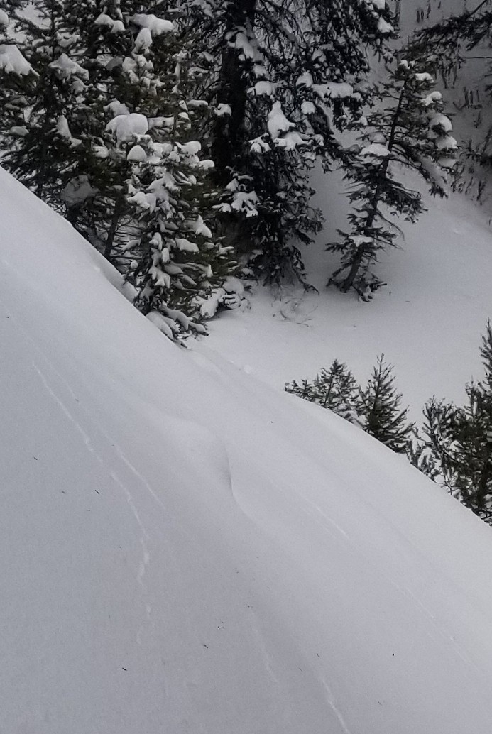
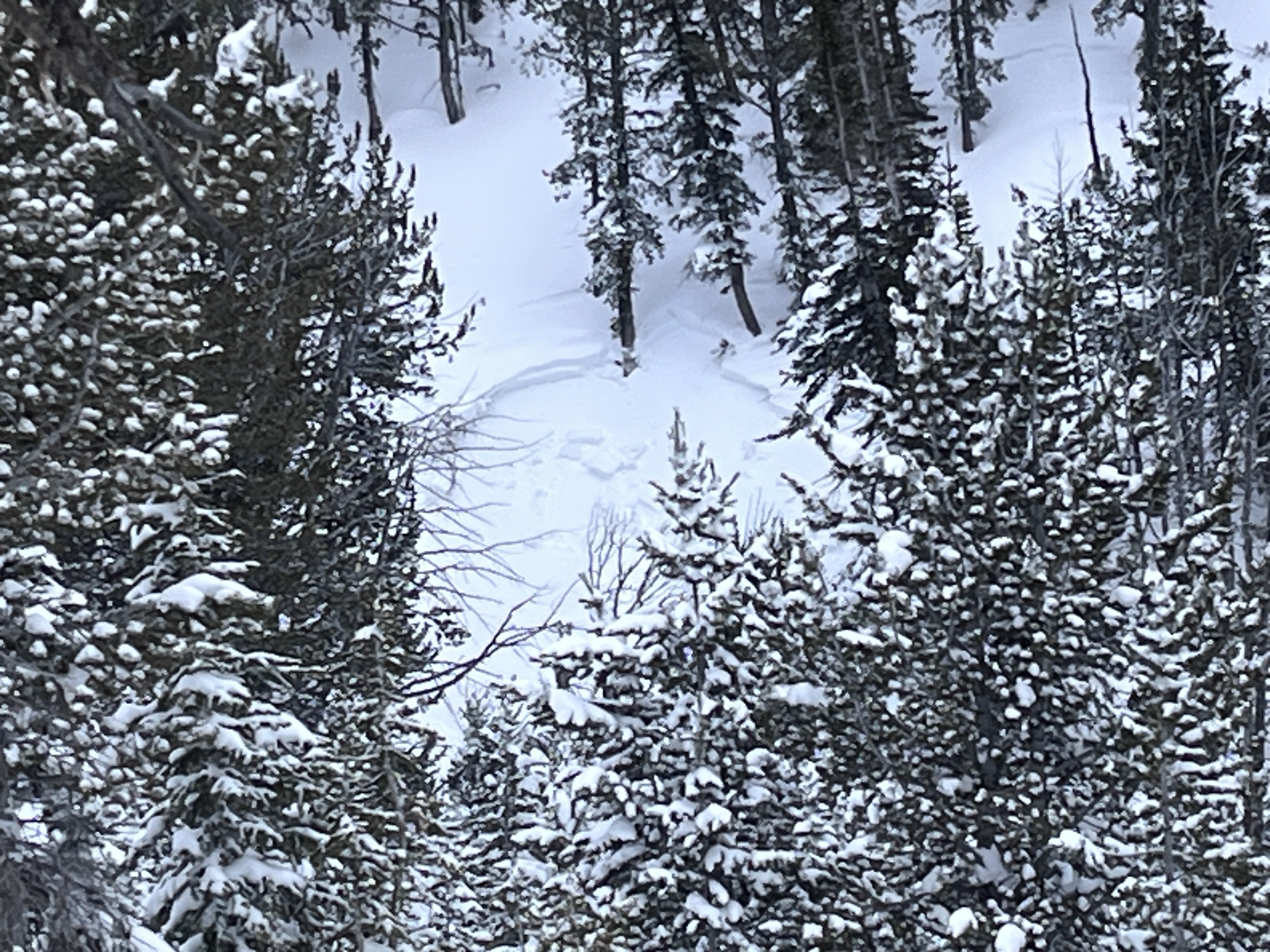
Full Snow Observation ReportObserved the avalanche breaking pretty far down the ridge, but I had a feeling it broke a little bigger judging by how fast the powder cloud was the moving. Went back up there today and saw that it had in fact, broke quite a bit bigger than the 8 inches and 50 feet I initially reported. Photo attached.
Full Snow Observation Report
A skier triggered an avalanche on the SE face of Mt. Blackmore near the ridge on the morning of 1/19/24.
From text: "Hard to with the visibility but it ran almost all the way to the skin track (~800 vertical). It definitely broke 8 inches deep and 50 ft wide, but it might've gotten a little wider and deeper."
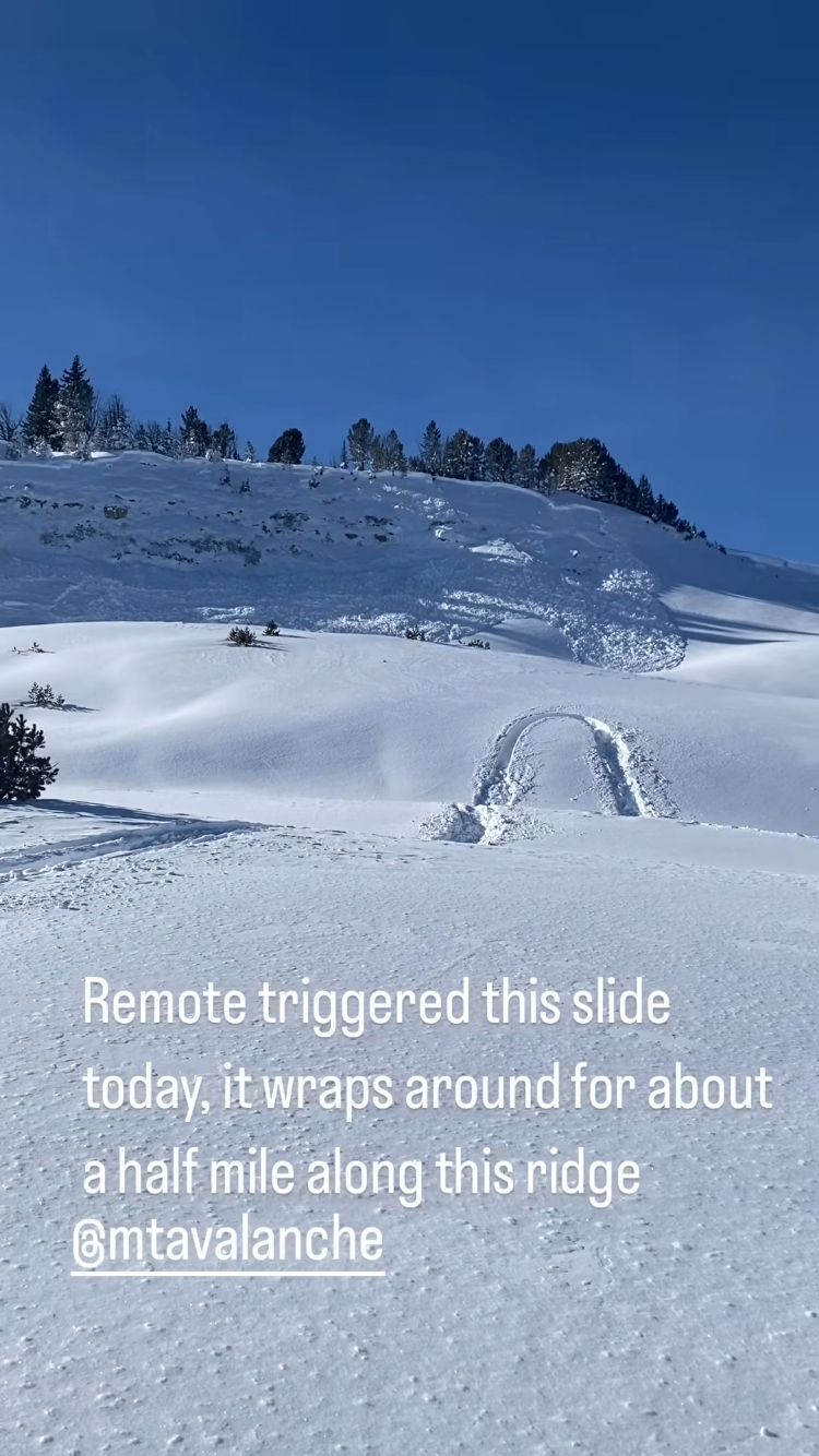
Full Snow Observation ReportMultiple remotely triggered avalanches. Lots of shooting cracks and visible whomping(poofs of snow dust).
Triggered from over 140 yards
Full Snow Observation Report
Photos from email. Avalanches previously reported - https://www.mtavalanche.com/node/30013
Full Snow Observation Report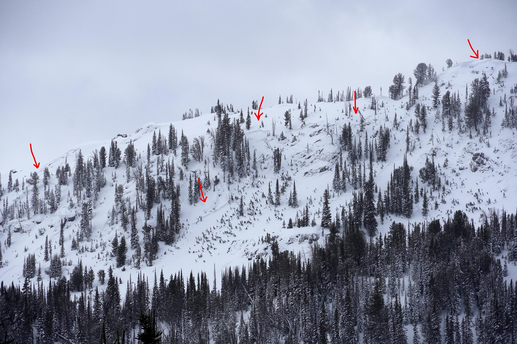
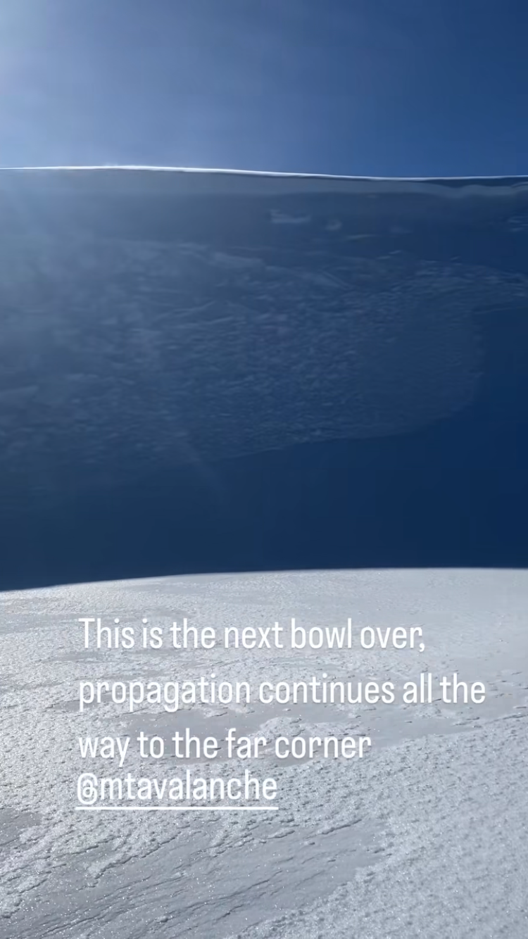
From IG: “…, probably propagated a mile long, on a layer of advanced facets 30cm below a wind slab… We dug a pit yesterday and got a ct4, ectp9, pst 25/100 on the same layer.”
Full Snow Observation Report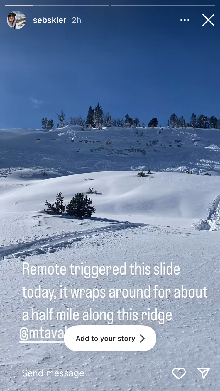

From facebook message: "Multiple remote triggers across this slope."
Up Targhee Creek, near Lionhead Ridge. 1/18/24
Full Snow Observation Report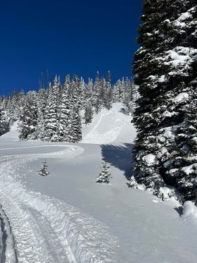

Natural & remote trigger avalanches observed on most steep terrain.
Full Snow Observation Report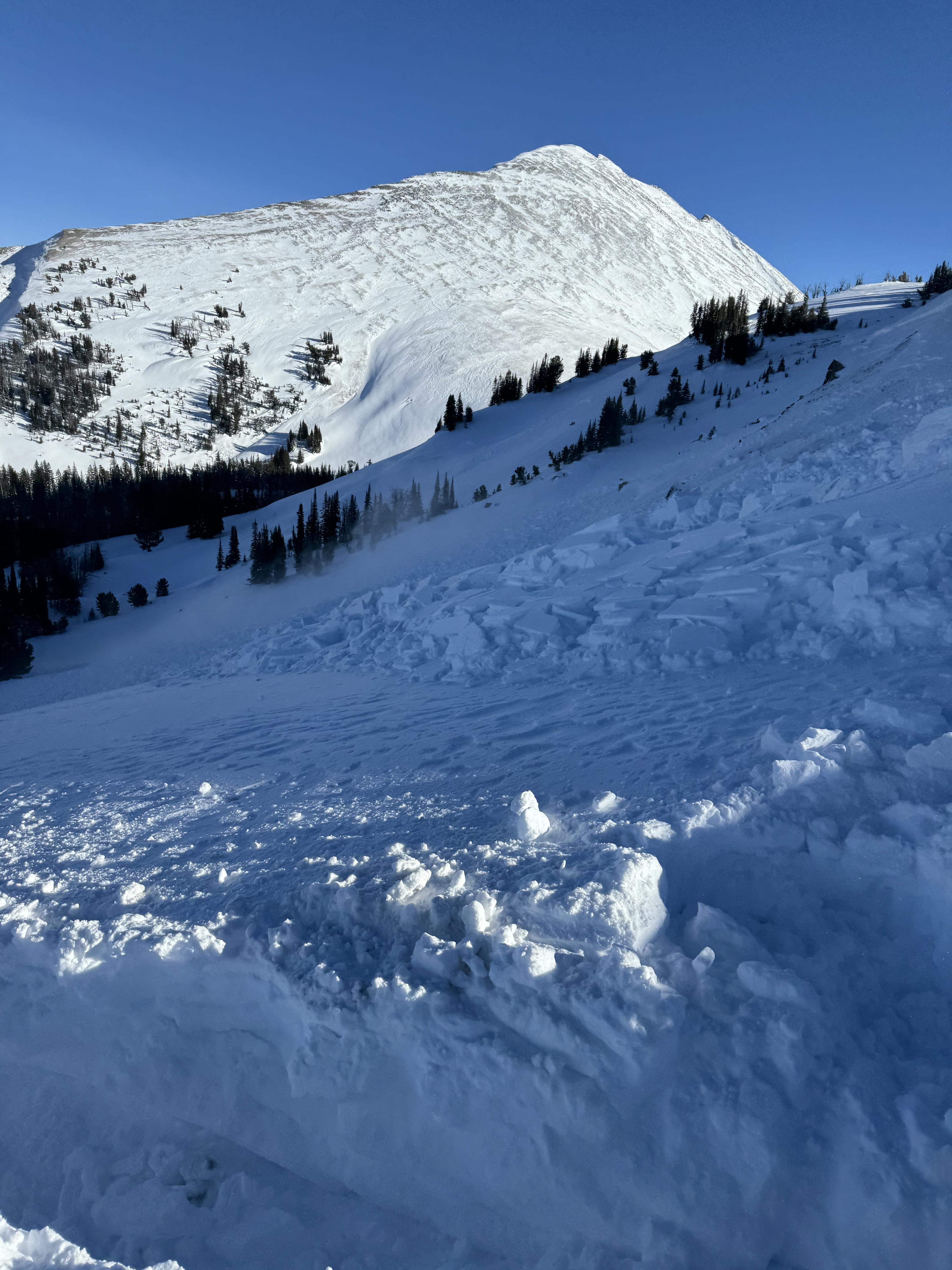
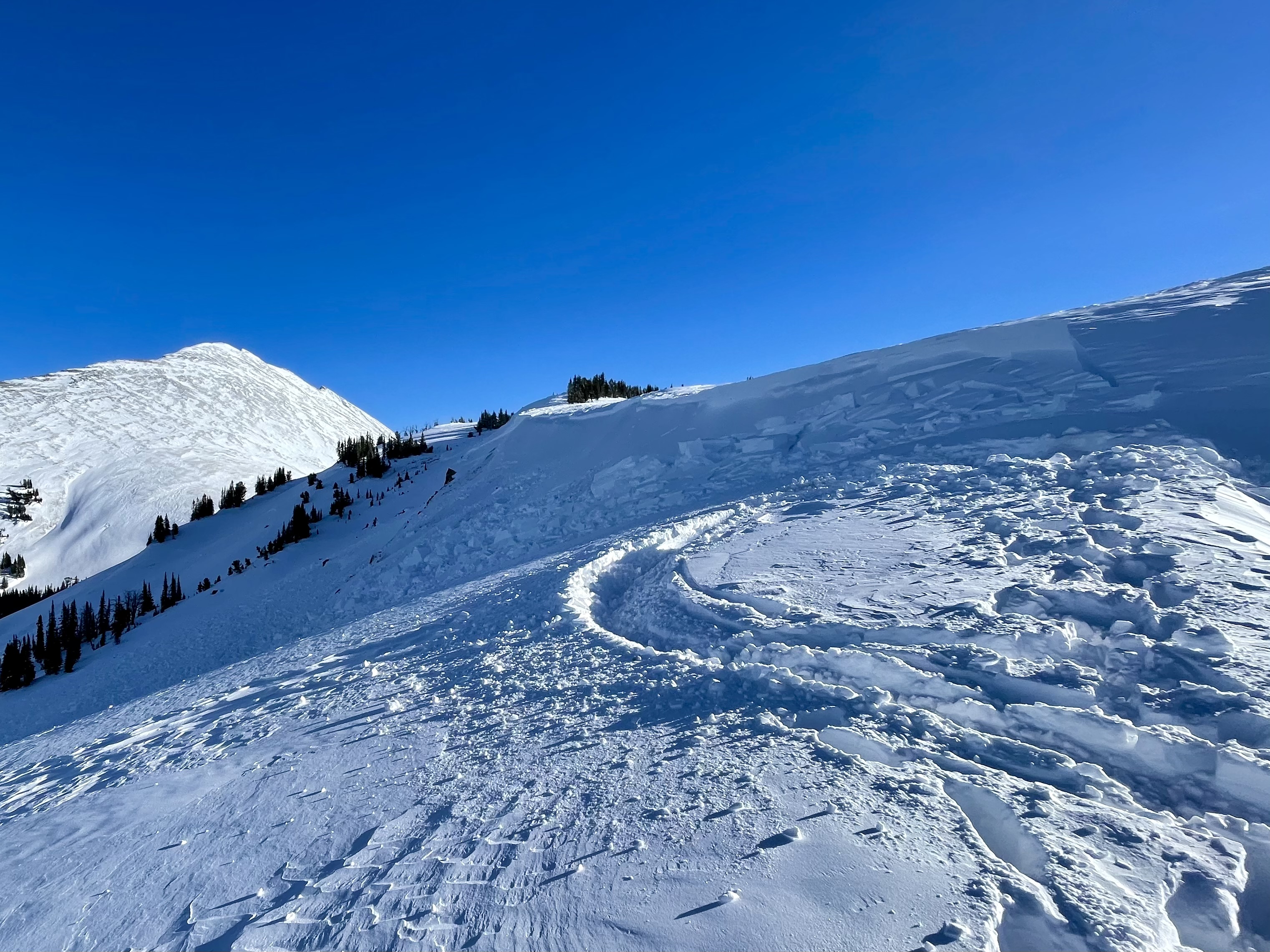
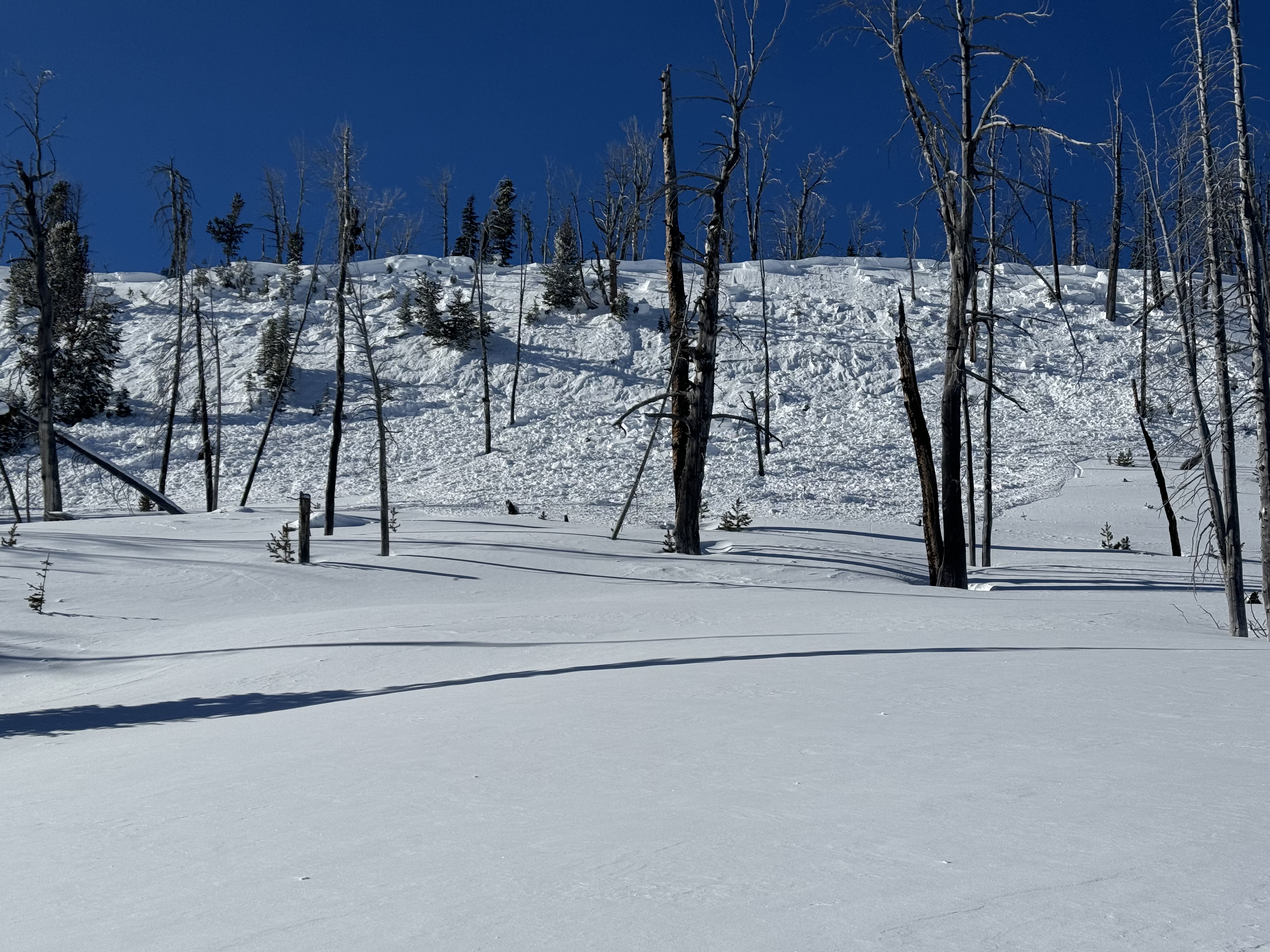
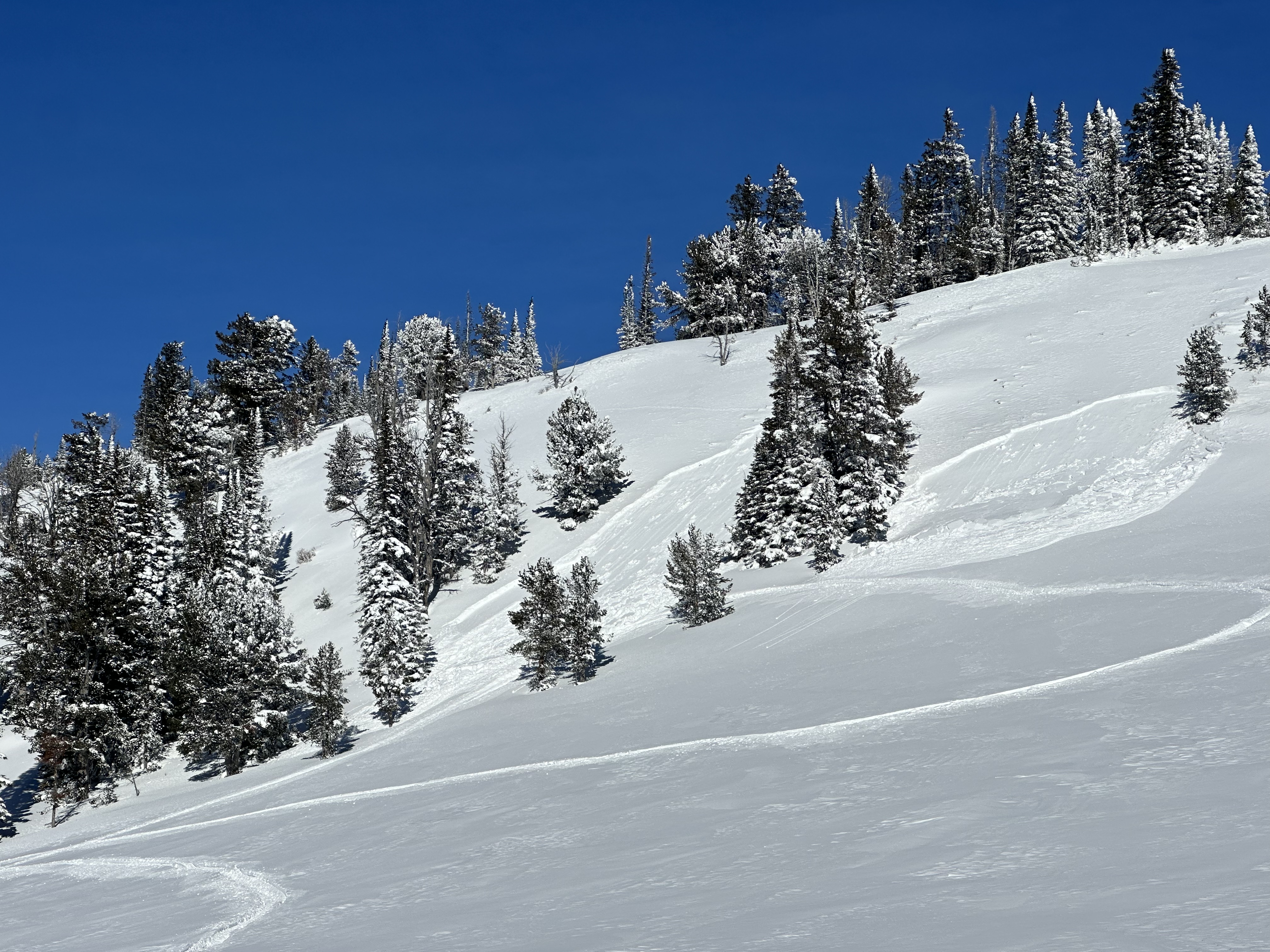
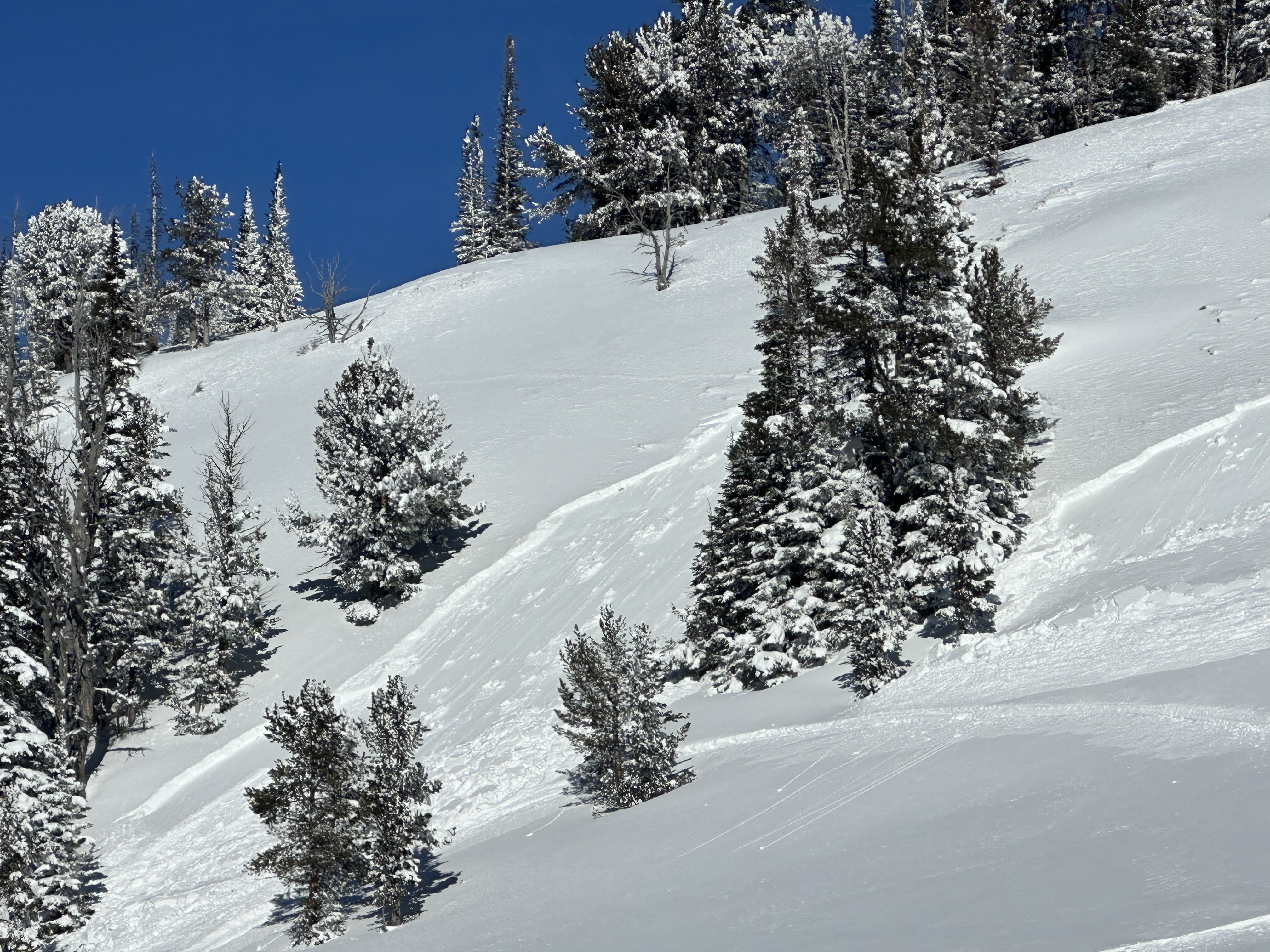
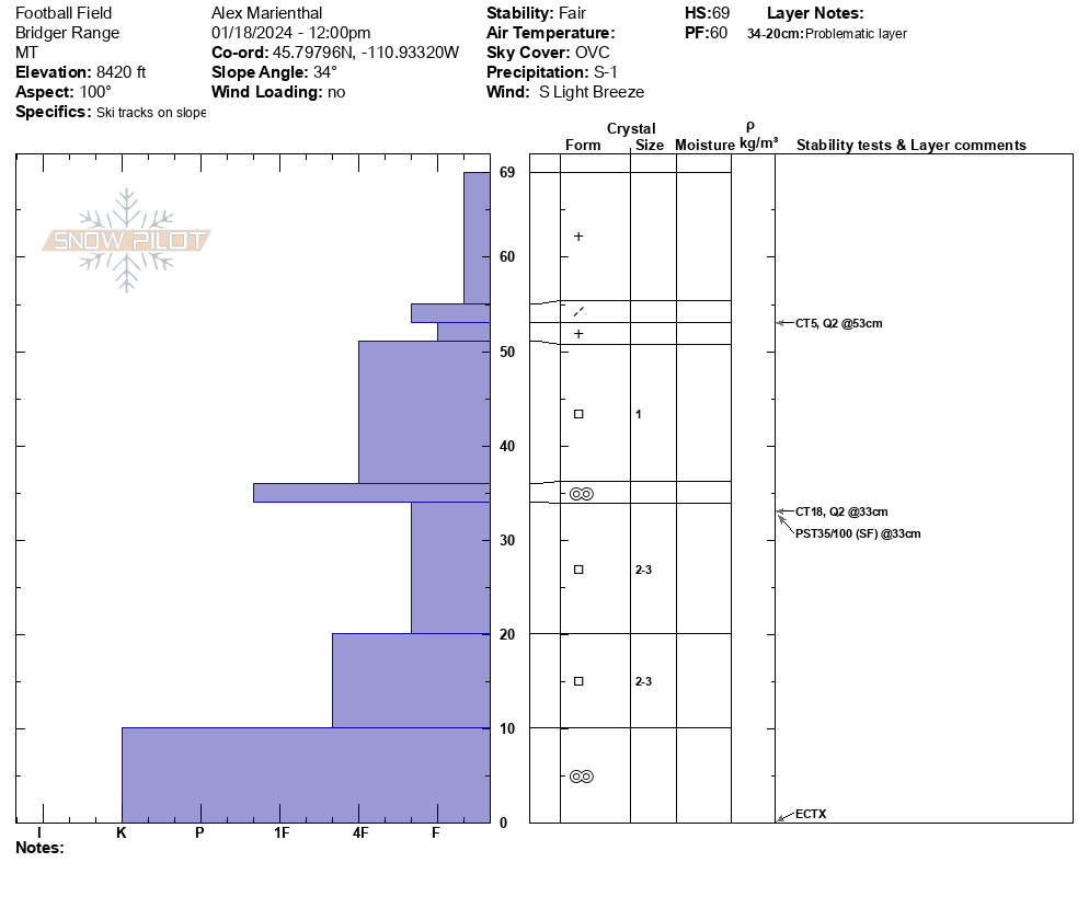
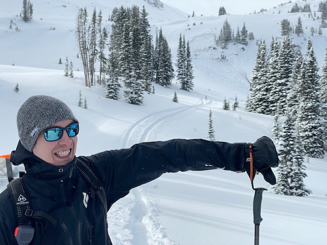
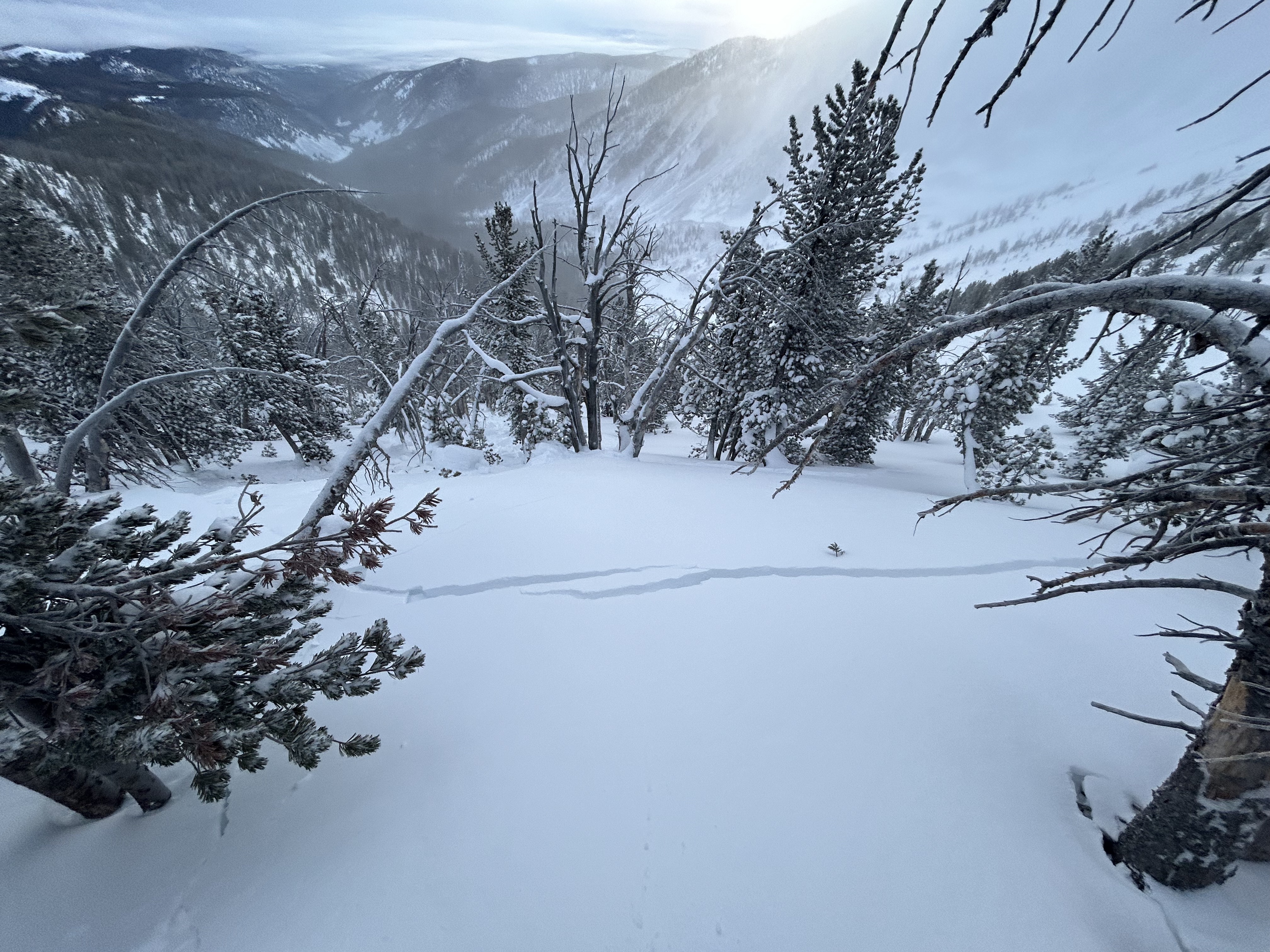
Alex and I began to dip our toes into a Saddle Peak stability assessment. Given the new snow and HIGH danger on wind-loaded terrain in the Bridger Range, we decided early to skip the summit and cross onto the edge of the Football Field from the Bridger Bowl boundary. Upper slopes had fresh drifts of wind-loaded snow and new cornice growth, but there was not as much loading as we feared there might be. We stuck to our conservative plan and skied the "Bitter End" (the closest run to the south boundary of the ski area) down to 8400' elevation before ducking out across the boundary.
The snowpack is thin and weak, with advanced facets making up most of it. Our test results did not reveal obvious instability, just weakness (ECTX). It is unreasonable to apply that same assessment across the Peak. Human-triggered avalanches are certainly possible, especially in areas with thicker slabs of wind-drifted snow (something that is quite common to find on Saddle Peak). Given the very high-consequence nature of the area, we advise patience and conservative terrain choices and decision-making.
Full Snow Observation ReportThe danger felt like a CONSIDERABLE / MODERATE split. We did not observe any thick or reactive wind slabs on the boundary, possibly due to avalanche mitigation efforts at the Bitter End. Alex and I discussed the summit and a Skyline assessment but decided to hold off since we have high pressure returning and the optics of doing so with a HIGH danger on the map.
Without wind tomorrow, Alex and I discussed a return to the MODERATE danger. Remain nimble with regard to incoming observations, strong winds, or more snow and hold it up if additional information suggests it.

115-120 cm HS @ 8250'
Temp in the low 20's. Overcast until at least 3 p.m.
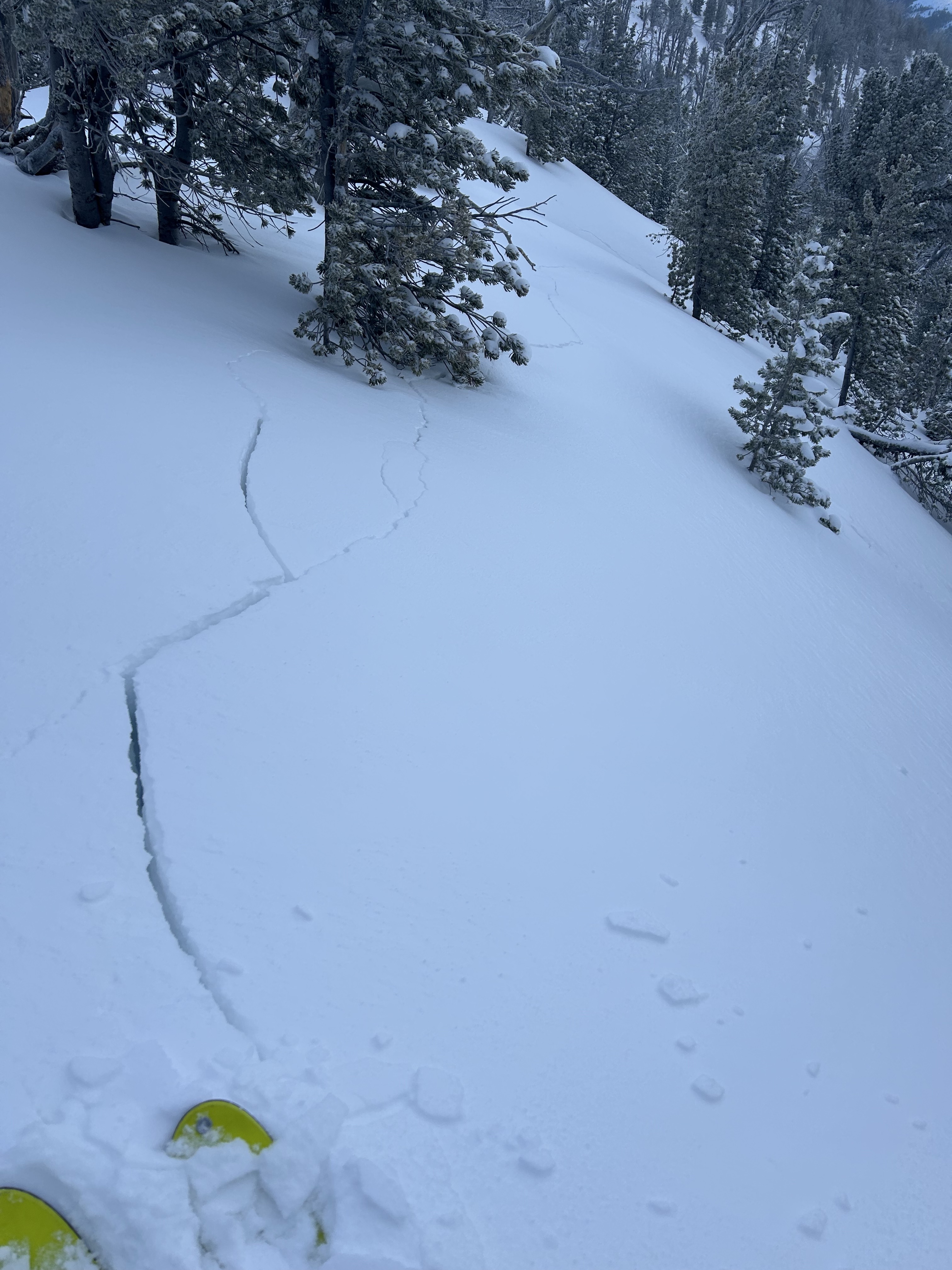
West side of tree trunks snowblasted by wind, both on the south and north sides of the ridge into Pebble Creek.
Experienced whoomphing starting at 8000', midway up the gully, south side of the ridge, where there was some wind deposition. Parallel cracks 10' apart - looked like "stretch" marks. Extensive whoomphing in the saddle and down in Pebble Creek Valley. Ski penetration = knee deep, and trail breaking was a bit of work today. 18" new snow at 8250' and in Pebble Creek. Snow was too deep for turns on mellow slopes, and too much collapsing to go steeper. Occasionally broke through the hard layer, into the hollow below.
Still windy in Pebble Creek (less than 10 mph), but definitely wind scoured. Looked like a natural avalanche on SE facing slope of the ridge to the N of Pebble Creek.
Coverage still slim down towards the highway.
Full Snow Observation Report
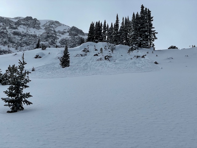
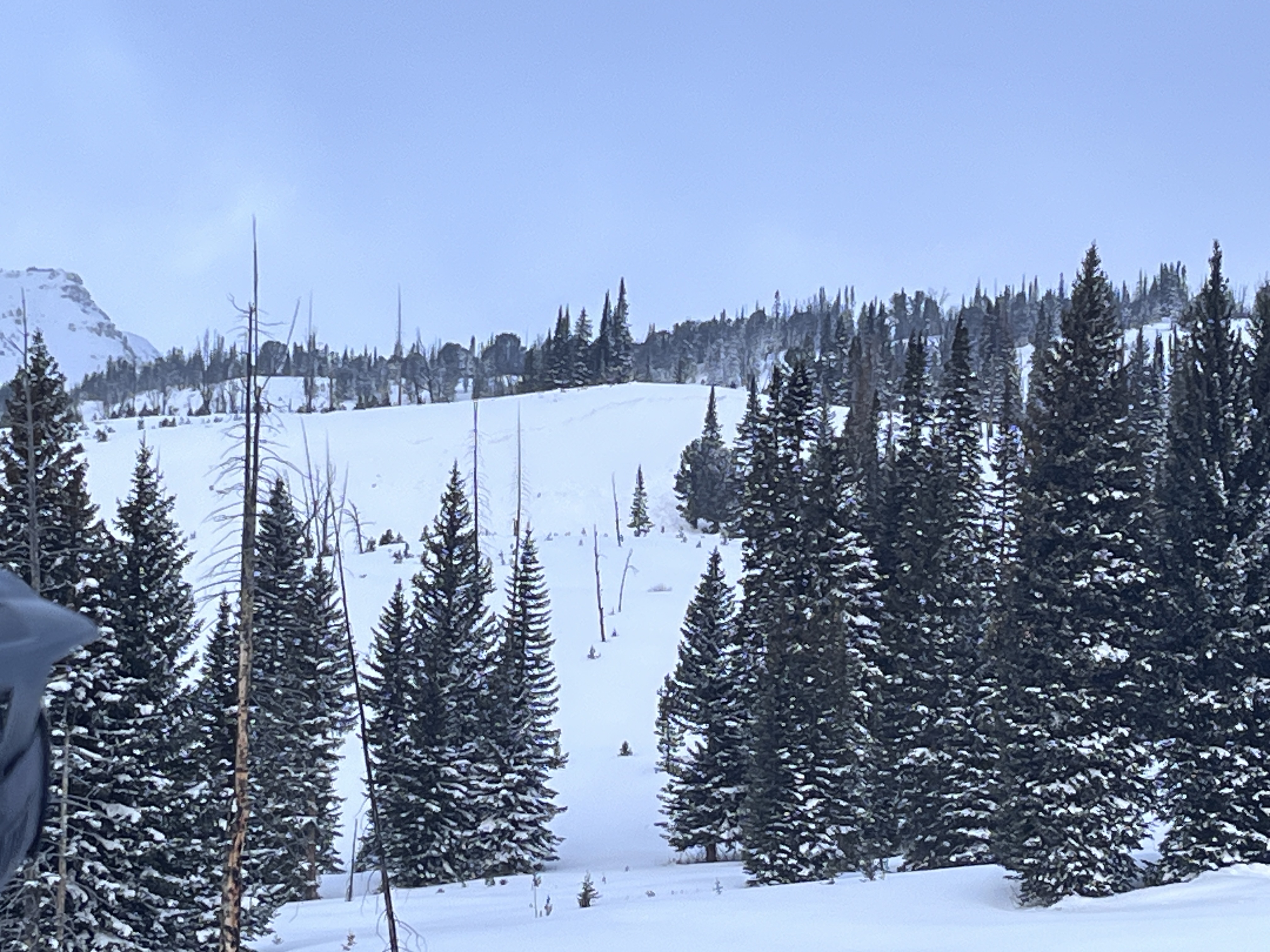
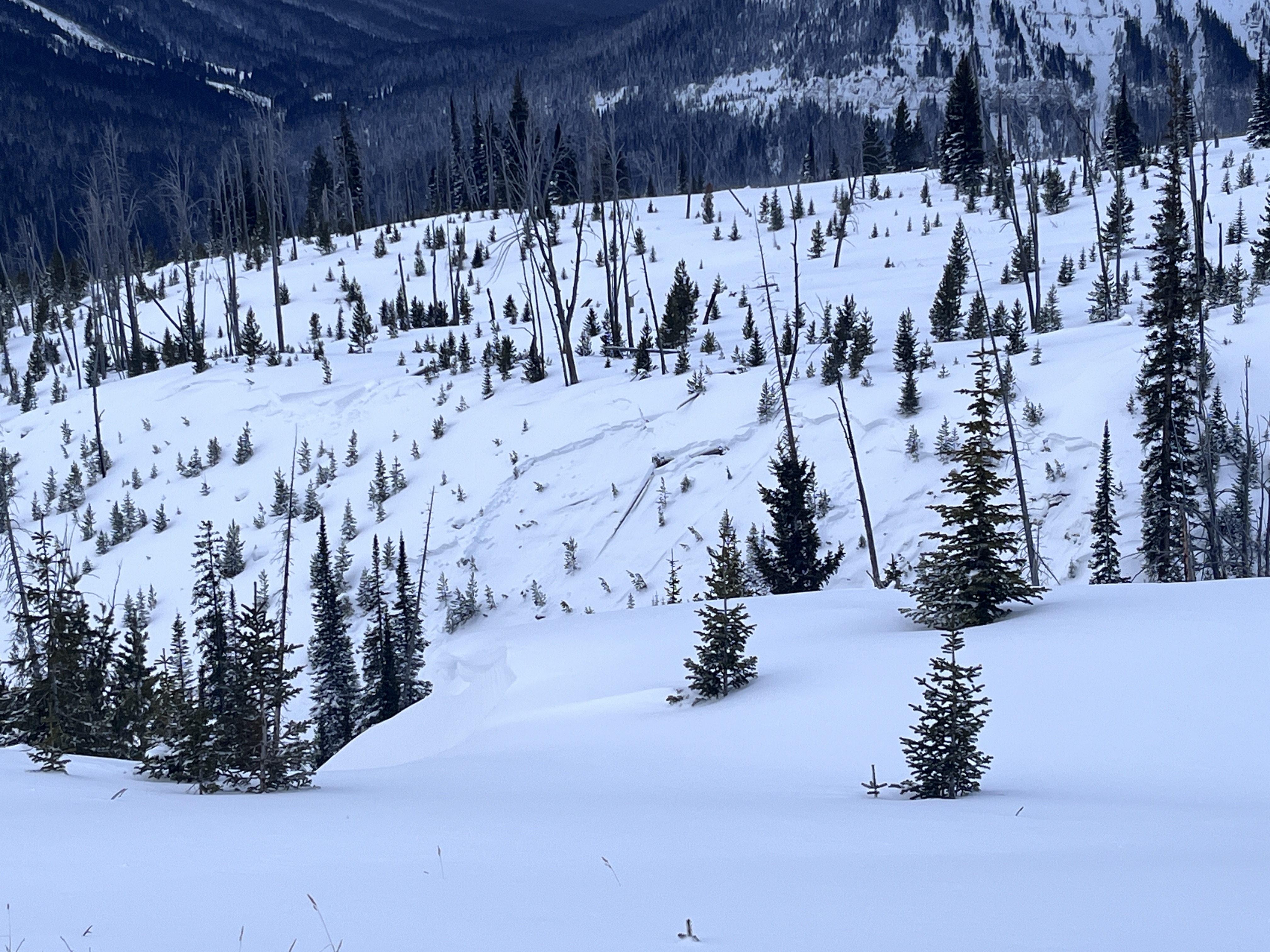
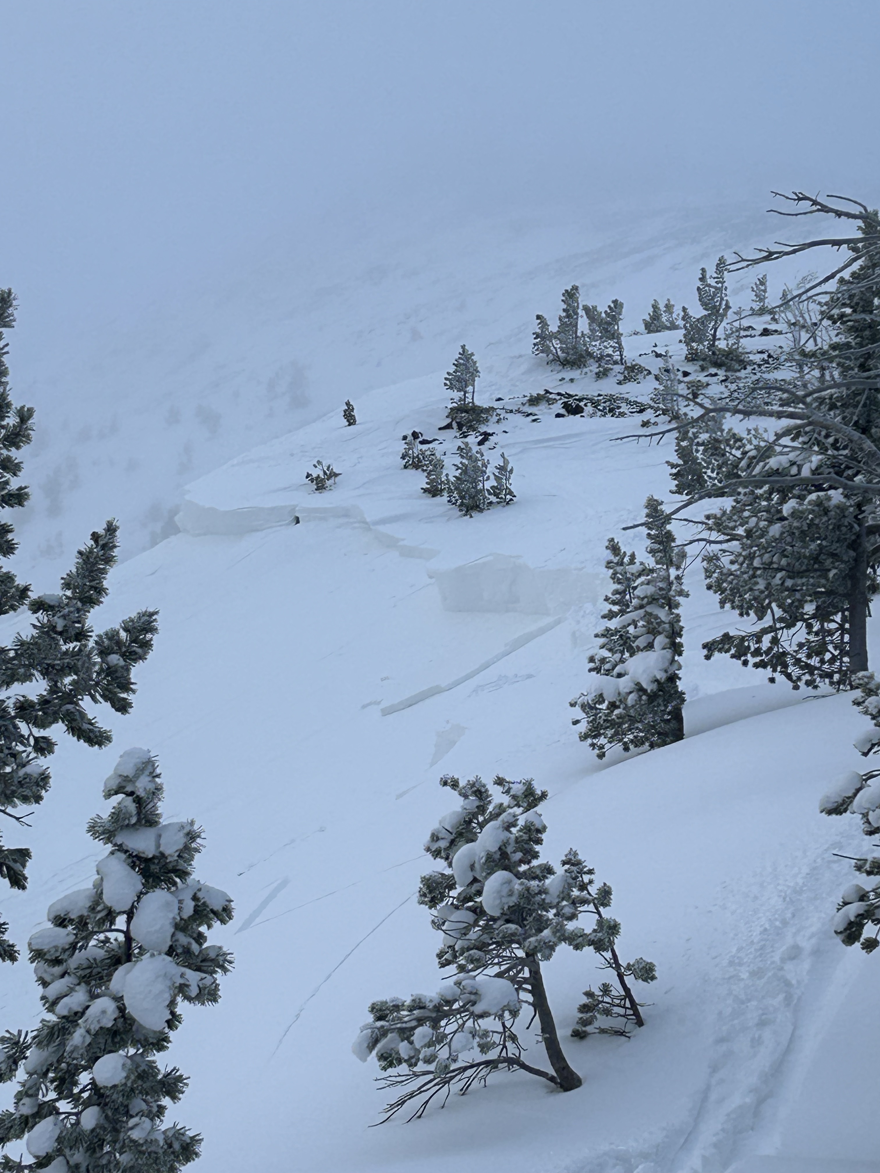
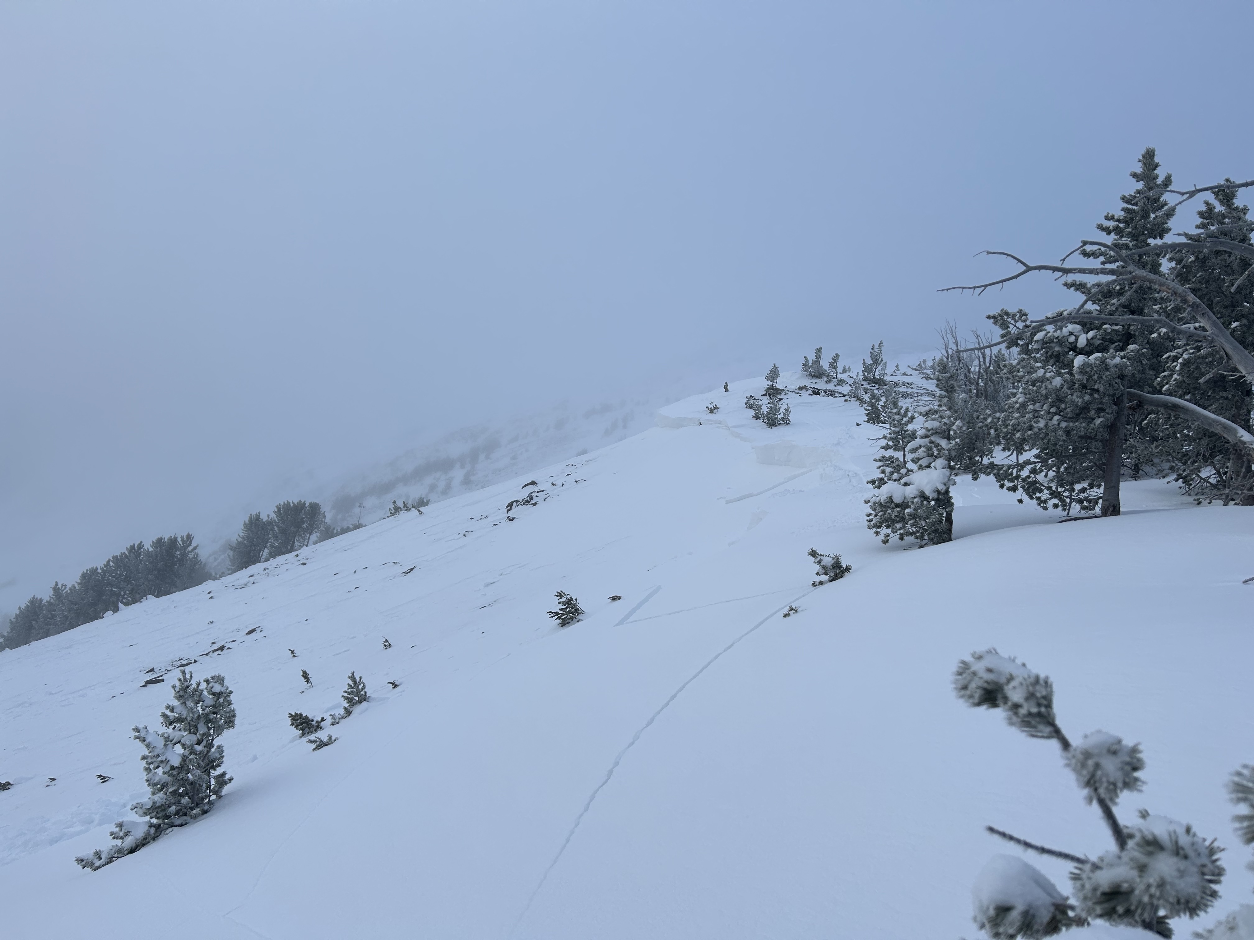
We skinned up towards Hyalite peak today to see how the snowpack was adjusting to this new load. While we did see some point release on the canyon walls during our approach, there was no collapsing and minimal wind effect below 9000 feet. As soon as we topped out into the hyalite lake basin, a northerly wind picked up and there were supportable wind drifts scatted about. Got an ECTx on a northern aspect at 9200' before deciding to ascend a 25 degree adjacent slope. About 50' from our pit we remotely triggered two D1 slab avalanches which broke on the roll over 150' above us. Crowns looked between 1-2' and 20-30' wide. The larger of the two ran 100' more or less. Yikes, time to bail! The low angle tree skiing along the skinner was quite nice.
Full Snow Observation Report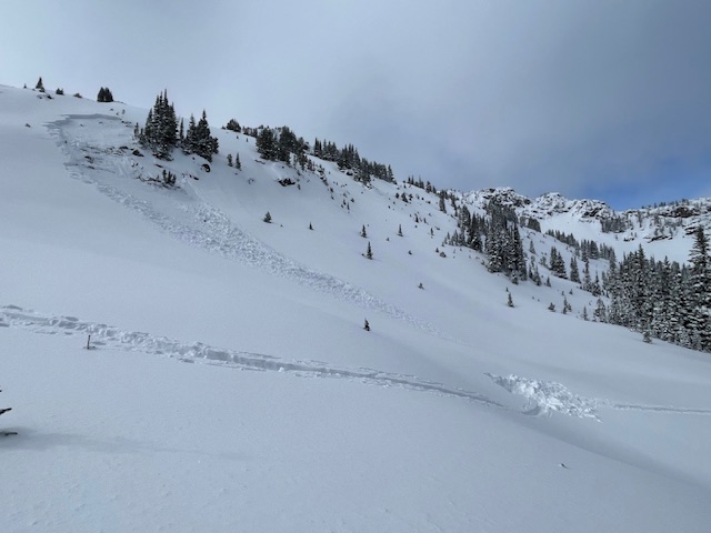
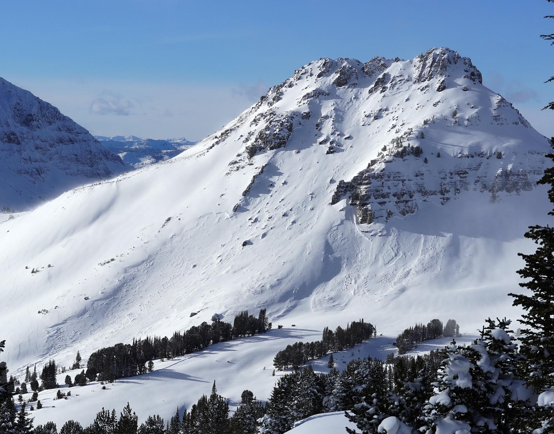
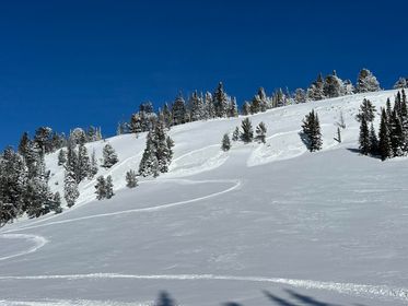
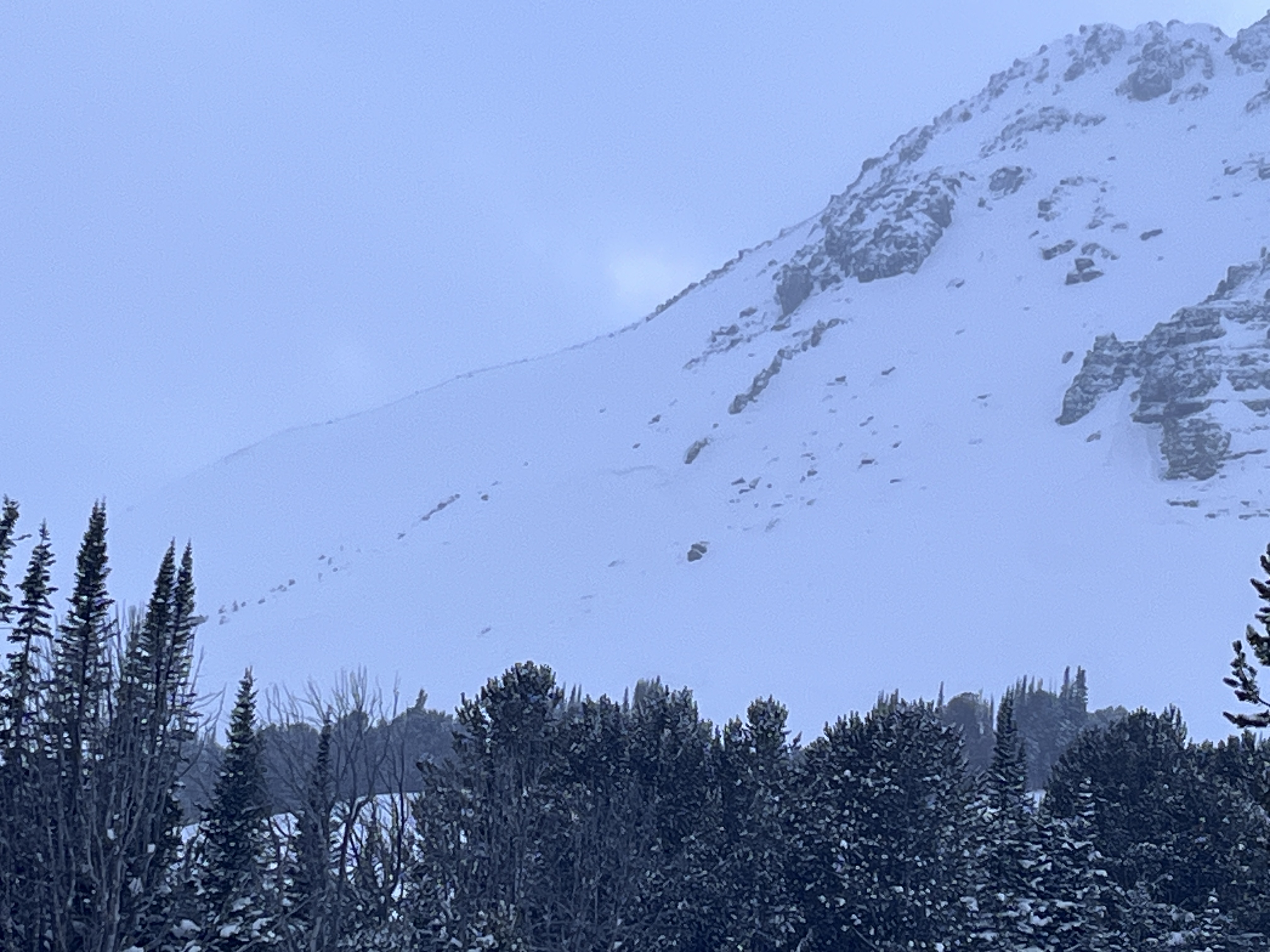
North of Cooke City we observed numerous avalanches that likely happened last night or early this morning as snowfall stopped. Partly cloudy skies gave us a good view of the terrain and ridgelines. In the Fisher Creek drainage, we saw multiple natural avalanches on the east side of Henderson Moutain, including just south of Henderson Mountain off the Lulu Pass Road. At the back of the drainage, we saw another avalanche on the shoulder of Scotch Bonnet Moutain. Crown depths ranged in size but from afar seemed to be 1-2' deep. Several of these avalanches are wide and in sheltered terrain at mid-slope.
On the other side of Henderson Moutain in the Miller Creek drainage, we observed avalanches in the gully near the Daisy Pass road. Along the east side of the Miller Ridge, we saw large natural avalanches that happened just below the ridge line. On the south side of Crown Butte, the story didn't change with two large avalanches happening mid-slope, and near the summit. Again these crowns ranged in depth from 1-2' deep and deeper on the south side of Crown Butte.
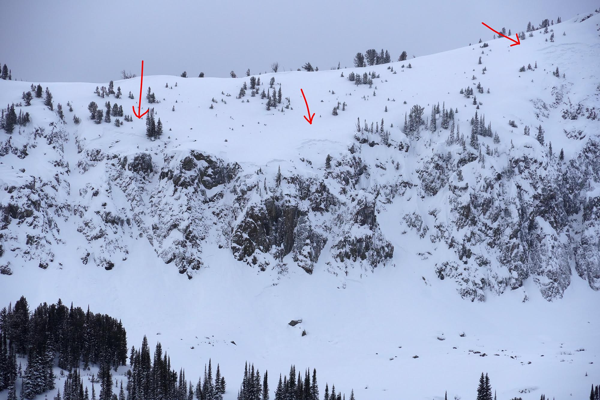
On the west side of Henderson Moutain, we transitioned to skis and began ascending a low-angle slope toward a known avalanche path. Along the way, we experienced several collapses. Halfway up the slope, Ian noted snowballs rolling down the hill and around the corner, we could see the debris that had come from the steep terrain above. We had a clear view of this slope near the snowmobiles and it had not avalanched when we began ascending. At some point from several hundred feet away, we remotely triggered the slope. The avalanche was ~150' wide, 2' deep and ran almost to the road. Across the gully, we could see large cracks but the slope did not avalanche. Above, cracking and collapsing continued and we got a view into the upper part of the gully and saw another crown of an avalanche that likely happened at the same time as the slope below.
Roads that were groomed last night and by 9 am had wind drifts that were a few feet in size. The snow has stopped but the wind remained blustery through the morning and into the afternoon. Getting on or under steep terrain today was certainly not in our travel plans, and it will remain that way at least through the weekend.
More photos and video coming soon!
Full Snow Observation Report

4-6" of new snow. active transport with increasing sw winds. NE facing ridge. 9200'.
Full Snow Observation Report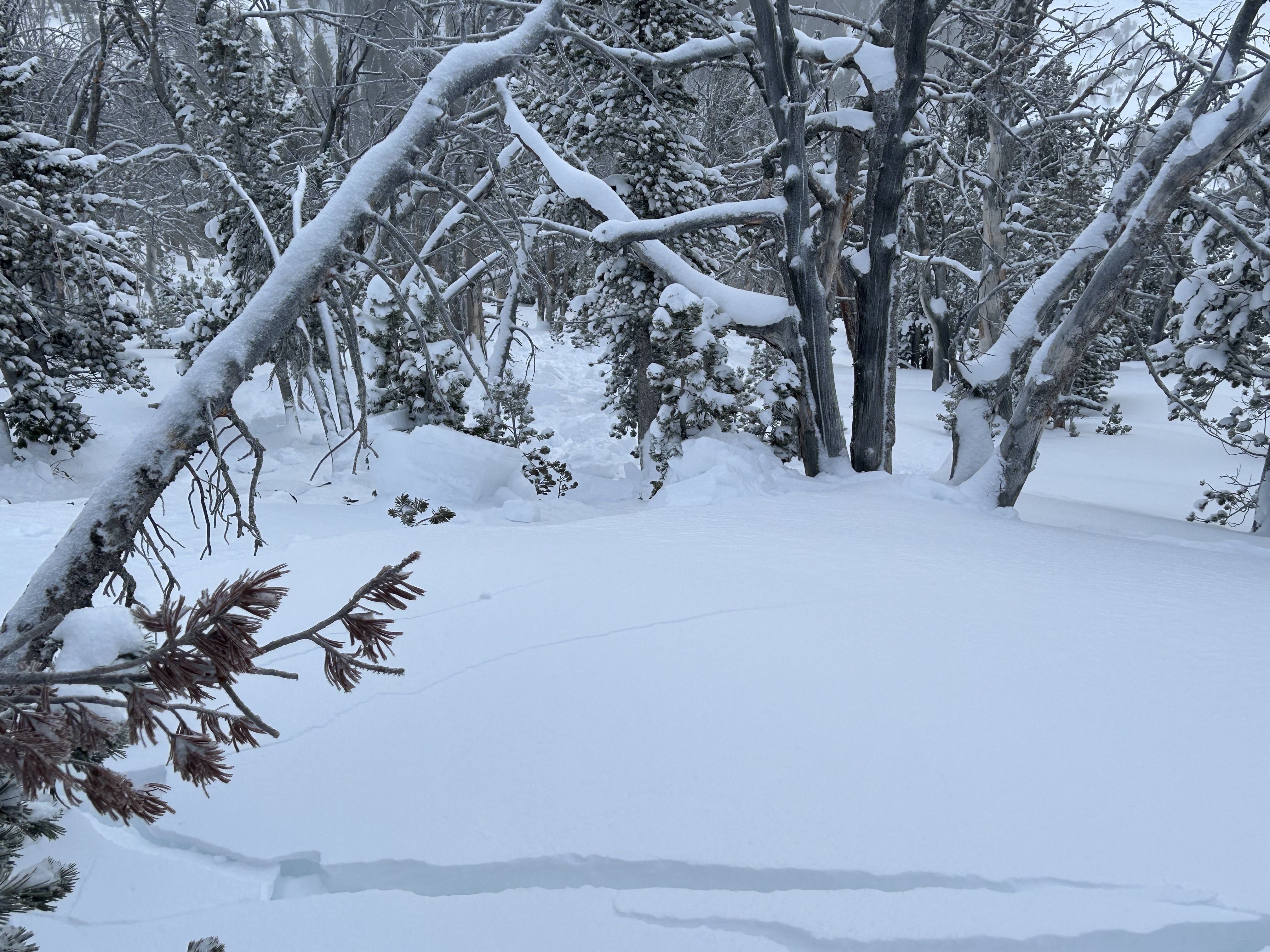
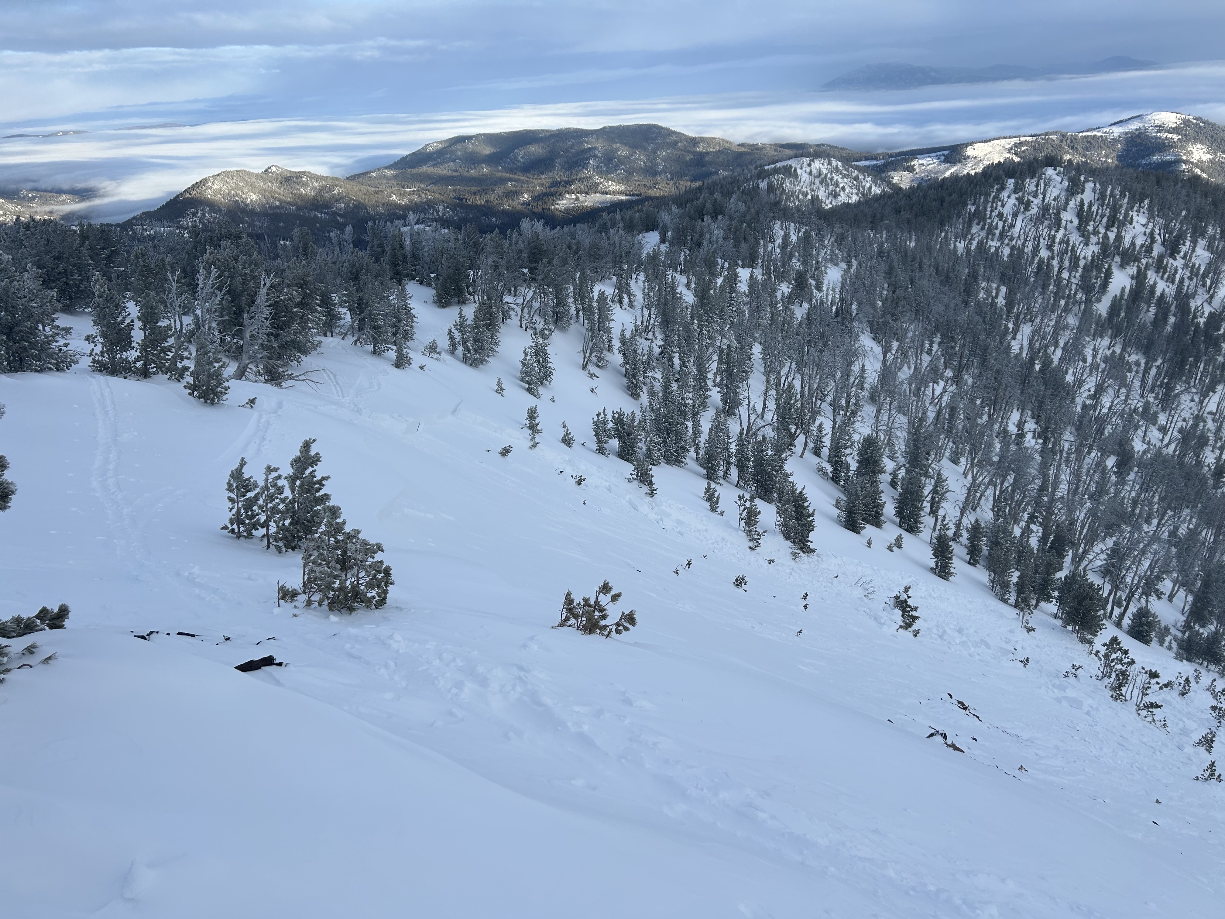

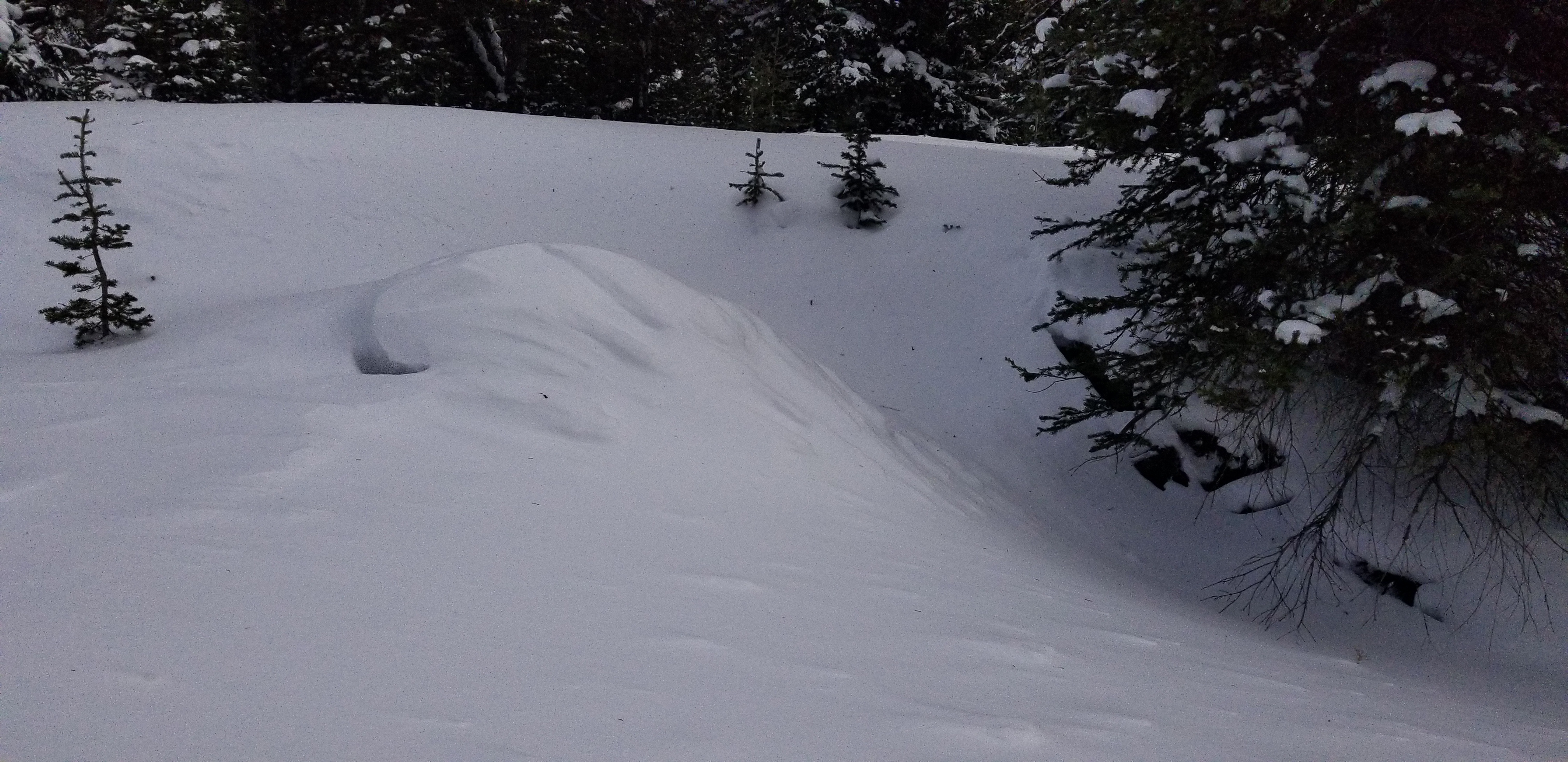
Went for a short tour near bacon rind, next pulloff to the south, toured up the burned out hill right across the street. It was real windy leaving my vehicle. Some notable whoomphing, and cracks forming 30 ft around me. I probably won’t be riding down there for a bit, the low angle stuff I like is too thin. Real thin down there with only about 40-60cm on the ground. Got a CT1 SC Q2 breaking about middle of snowpack, ectn 2, and ectp24.
Full Snow Observation Report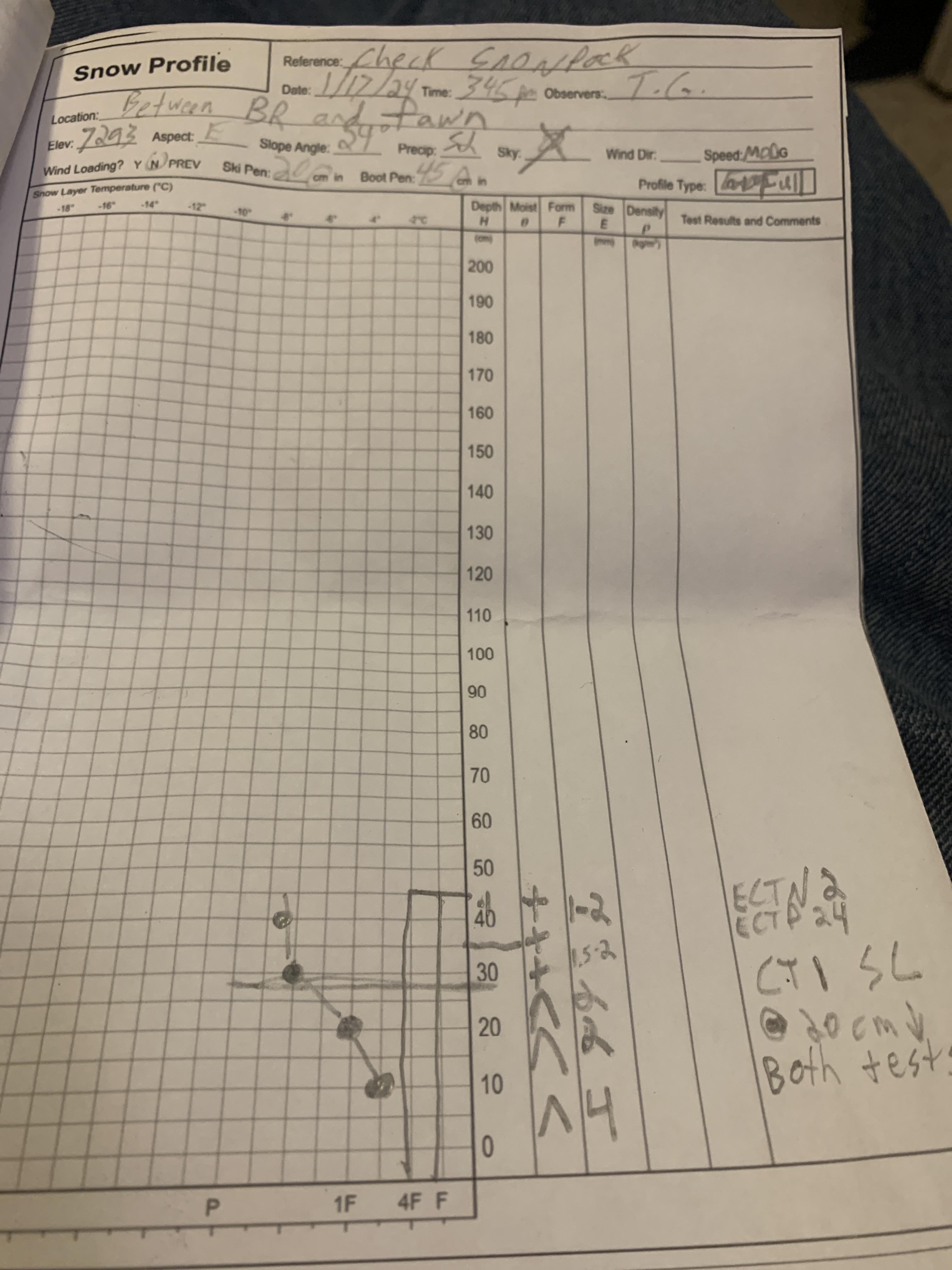
Moderate to Strong, SW winds were picking up this evening at Lick Creek, resulting in moderate snow transport along the ground. Previous drifts were building in leeward aspects and small terrain features, and I noted several areas of very dense wind board while skiing and touring. I also observed some local collapsing of these wind slabs around my skis, and would expect this issue to be exacerbated higher elevations by increased wind transport and the widespread presence of pwls. I was surprised by the amount of snow available for transport, especially at the relatively low elevation, and was glad to be in simple, low-angle, terrain.
Full Snow Observation ReportGenerally stiffer and more supportive wind slab in the upper snowpack overlying early season facets. Our approach track to Frazier basin was filled back in by wind load by the time we exited the zone( less than one hour)
Full Snow Observation Report
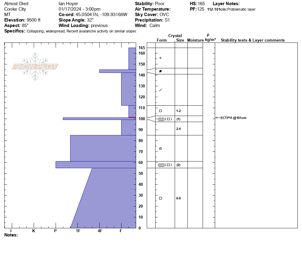
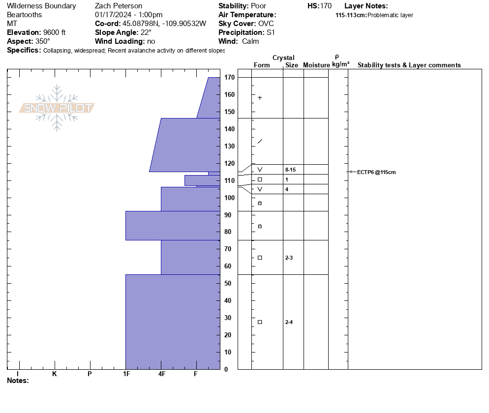
We rode to the bottom of an avalanche on Sheep Mountain that had been triggered by riders from the bottom. This avalanche happened on Monday, 01/14, but by today it had been filled in by recent winds and new snow. From here we worked our way north of Round Lake and found 10"-12" of new snow (0.5" SWE), compared to the 5" of new snow near Sheep Mountain. Near the wilderness boundary, we found unstable snow and while getting a snowmobile unstuck in the flats remotely triggered a small avalanche from 100' away. We then rode to a northern aspect at 9600' and found 170 cm of snow and had poor results in our stability tests, with an ECTP 6 on buried weak layers below the last week and a half of storms.
From here we rode to the top of Henderson Bench and dug on an east-facing slope at 9500'. While walking to our snowpit location we collapsed the slope and a small pocket of snow below a tree avalanched. Here we again had poor stability test results, ECTP 11, this area had previously been wind-loaded during last week's storm. Storm totals here were less than what we found north of Round Lake, with 5" of new snow at 3 pm (0.2" of SWE).
Wind through the day was calm but is expected to increase tonight. Snow will continue tonight into tomorrow morning. Expect danger to rise as snow totals increase and wind begins transporting snow.

From FB: Taylor’s Fork today, 8-10 inches of new snow last night. A few small slides but tons of cracking.
Full Snow Observation ReportFrom FB