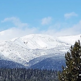
Good morning. This is Ian Hoyer with the Gallatin National Forest Avalanche Forecast issued on Tuesday, February 26th at 7:00 a.m. Today’s forecast is sponsored by Knoff Group Real Estate and Spark R&D. This forecast does not apply to operating ski areas.
AVALANCHE WARNING
The Gallatin National Forest Avalanche Center is issuing a Backcountry Avalanche Warning for the Southern Gallatin and Southern Madison Ranges, the Lionhead area near West Yellowstone, the Centennial Range, and the mountains around Cooke City. Heavy snowfall and strong wind are creating very dangerous avalanche conditions. Natural and human triggered avalanches are likely. Avalanche terrain and avalanche runout zones should be avoided. The avalanche danger is rated HIGH on all slopes.
Heavy snowfall brought 17-20” south of Big Sky and near West Yellowstone, 14” near Cooke City, a spotty 3-8” near Bozeman and Big Sky. An inversion near Bozeman has low elevation temperatures below 0F. Temperatures are 20s F elsewhere. Winds are southwest at 20-30 mph with gusts over 50 mph, and 10-25 mph in the Bridger Range. Temperatures will rise into the high 20s and winds will remain moderate out of the southwest. Snow will continue through the day, increasing overnight. By morning the mountains will have 12-18” of new snow near West Yellowstone and Cooke City with 4-8” near Bozeman and Big Sky.
Avalanche Warning
Since yesterday morning the southern ranges and mountains near Cooke City received another 1-1.5 feet of new snow (1.4-2.0” of snow water equivalent). This brings 48 hour snow totals to between 2 and 3 feet (2.8-4.2” of SWE). Strong southwest winds have drifted this snow into even thicker slabs on windloaded slopes. Large natural and human triggered avalanches of new and wind-drifted snow are likely today. Huge avalanches breaking on weak layers at the base of the snowpack are also possible (video, video). Yesterday in Cooke City, an avalanche was seen on a hill just above town and a rider was partially buried by a large avalanche (photo, details). Avoid all steep slopes and the runout zones below. The avalanche danger is HIGH on all slopes.
Yesterday on Buck Ridge, near Big Sky, I found unstable drifts of new snow formed by strong southwest winds (video). These 1-2’ deep wind drifts will be easily triggered today in the northern ranges. Beware below fresh cornices and on thick pillows of wind drifted snow just below ridgelines. If you feel the snow surface suddenly become firm, or see cracks shooting out in front of your sled or skis, you have found these dangerous conditions. With more snow and continued strong winds today these drifts will grow larger and become increasingly unstable. Avoid steep wind-loaded terrain. You could also trigger a much larger avalanche on weak layers deep in the snowpack (photo, photo, video). These avalanches are most likely on heavily wind loaded slopes, or where the snowpack is relatively shallow (less than 3-5 feet). With continued snowfall and strong winds, the avalanche danger is CONSIDERABLE on windloaded slopes. On all other slopes, the avalanche danger is MODERATE.
If you get out and have any avalanche or snowpack observations to share, contact us via our website, email (mtavalanche@gmail.com), phone (406-587-6984), or Instagram (#gnfacobs).
Upcoming Avalanche Education and Events
Our education calendar is full of awareness lectures and field courses. Check it out: Events and Education Calendar.
BOZEMAN
March 1, 2 and 3, Bozeman Split Fest, More info at www.bozemansplitfest.com.
March 6, 1-hr Avalanche Awareness, 6-7 p.m. at REI Bozeman.
ENNIS
February 28 and March 3, Intro to Avalanches w/ Field Day, More Info and Register Here.
COOKE CITY
Every Friday and Saturday, Rescue Training and Snowpack Update. Friday 6:30-7:30 p.m. at the Soda Butte Lodge. Saturday anytime between 10-2 @ Round Lake.
Sixteen people have died in avalanches across the U.S this winter (‘18/’19). Take a few minutes to read this season’s avalanche fatality reports. These reports provide a great opportunity to learn from these tragic accidents.


