Good morning. This is Doug Chabot with the Gallatin National Forest Avalanche Forecast on Wednesday, January 26th at 7:00 a.m. This information is sponsored by Grizzly Outfitters and Uphill Pursuits. This forecast does not apply to operating ski areas.
This morning there is no new snow to report, only strong wind blowing southwest to northwest. Around Bozeman and Big Sky speeds are averaging 20-30 mph with gusts of 47 mph while in the south it is averaging 10-15 mph with gusts of 25 mph. Clouds will dissipate this morning and sun will dominate as temperatures rise from the teens to the low 20s. Wind will be mostly west to northwest as speeds lessen today. Tonight it will snow, but just a little, with 1-2” expected by morning.
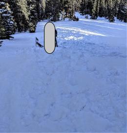
The arithmetic is basic: Wind + snow = wind slabs. 4-6” of snow that fell in Hyalite and Big Sky Monday night got blown into thicker drifts that can be triggered today. On slopes not affected by the wind it’s unlikely to trigger an avalanche. Ian and I were on Wheeler Mountain in the northern Gallatin Range yesterday and found sugary, faceted snow that would not support our weight when we stepped out of our skis (video). We also found 6” of new snow that was likely blown into drifts last night. A skier on Divide Peak and the Big Sky Ski Patrol also reported fresh snow available for transport.
Wind drifts are most susceptible to triggering when they are new, like today. Shooting cracks are a sign that slabs of windblown snow can avalanche. Be wary near ridgetops. On slopes without wind loading it’s a good habit to dig and test before getting on steep terrain no matter the danger rating. For today the avalanche danger is rated MODERATE on wind loaded slopes and LOW on all others.
The Bridger Range is windy, but lacks new snow to blow around. The southern mountains to West Yellowstone and Cooke City are calmer. Without new snow to load slopes or get blown into drifts the snowpack is generally stable and avalanches are unlikely. A buried weak layer of surface hoar is still lurking a foot or so under the surface in our southern mountains, but is not a serious concern…yet. It needs to get buried deeper, which may take a while given our paltry storms. Alex shows us this layer and reminds us to look for signs of instability like shooting cracks in his video from Taylor Fork this weekend. To avoid getting unlucky and finding a rogue instability, do a quick stability test before exposing yourself to serious terrain. For today the avalanche danger is rated LOW.
If you get out, please send us your observations no matter how brief. You can submit them via our website, email (mtavalanche@gmail.com), phone (406-587-6984), or Instagram (#gnfacobs).
Upcoming Education Opportunities
See our education calendar for an up-to-date list of all local classes. Here are a few select upcoming events and opportunities to check out:
February 4th, Dillon Montana Avalanche Fundamentals, three-part series of pre-recorded lectures, virtual Q&A and an in-person field session. Pre-registration and more information HERE.
February 5th, King and Queen of the Ridge at Bridger Bowl. Come hike and ski with your friends for avalanche awareness and fun! Details below.
Every Saturday near Cooke City, 10 a.m.-3 p.m. FREE snowpack update and transceiver/rescue training. Stop by for 20 minutes or more at the Round Lake Warming Hut.
KING AND QUEEN OF THE RIDGE, FEBRUARY 5TH
Do you like to hike? Do you like to ski? Then the King & Queen of the Ridge is for you. Hike, ski and raise money for the Friends of the Avalanche Center in their 2nd biggest fundraiser of the year. Join the effort to promote and support avalanche safety and awareness! Fundraising prizes for top 5 individuals who raise over $500. No racing is necessary to compete for the fundraising prizes. Info is HERE. Race participants for the February 5th event must register separately with Bridger Bowl HERE.
The Beacon Park at Beall Park in Bozeman and the West Yellowstone Beacon Park are up and running! Stop by to check them out and practice with your rescue gear.


